Quick Answer: Why was the Nile River important to ancient Egypt?
The Nile River was essential to ancient Egypt because it provided fresh water, fertile farmland, food, transportation, and trade routes that allowed civilization to flourish in an otherwise dry landscape. Its annual floods deposited nutrient-rich silt, supporting agriculture and economic growth. The Nile also shaped Egyptian religion, government, engineering, and daily life, helping sustain one of the world’s most influential ancient civilizations for thousands of years.
The ancient Egyptians did not build their civilization beside the Nile by coincidence. They depended on a river that transformed narrow stretches of desert into productive farmland, connected distant settlements, and made large cities and monumental construction possible.
Every year, seasonal rainfall far upstream caused the river to rise in Egypt. When the floodwaters retreated, they left behind fertile soil that farmers could cultivate. This natural cycle helped determine when people planted crops, collected harvests, celebrated religious festivals, and organized their work.
The Nile’s influence extended far beyond farming. Boats carried limestone for royal building projects, merchants transported goods between Upper and Lower Egypt, and temples honored deities associated with water and fertility.
One of the most remarkable aspects of ancient Egypt is that its civilization developed around a natural system whose benefits were considerable but never guaranteed. A good flood could bring prosperity. An exceptionally low or destructive flood could threaten entire communities.
Understanding the Nile helps explain not only how ancient Egypt survived but also why its cities, temples, pyramids, and traditions developed where they did.
What Made the Nile River So Important to Ancient Egypt?
The Nile was important because it performed several essential functions at once. It was a freshwater resource, an agricultural foundation, a transportation network, a food source, and a central influence on Egyptian religion and political organization.
These functions reinforced one another.
Reliable agricultural production supported a growing population. A larger population made specialized occupations possible. Transportation along the Nile helped distribute grain, move workers, and deliver building materials. Political institutions coordinated these resources, while religious traditions gave meaning to the river’s annual cycle.
The main reasons the Nile River was important to ancient Egypt were:
- Fresh water: The river supplied water for people, animals, and agriculture.
- Fertile soil: Annual floods deposited silt that renewed farmland.
- Food production: Irrigated fields supported crops, livestock, and large communities.
- Transportation: Boats connected settlements along the Nile Valley and Delta.
- Trade: Merchants used the river to exchange goods and transport resources.
- Economic growth: Agricultural surpluses supported craftspeople, administrators, and major construction projects.
- Political unity: The river connected Upper and Lower Egypt and supported centralized administration.
- Religion: The flooding cycle influenced Egyptian gods, rituals, festivals, and beliefs about renewal.
- Engineering: Irrigation systems, boats, canals, and measuring devices developed around the river.
- Daily life and culture: The Nile shaped settlement patterns, work, fishing, recreation, art, and the Egyptian understanding of their homeland.
The Nile’s importance at a glance
| Area of ancient Egyptian life | What the Nile provided | Why it mattered |
| Agriculture | Water and fertile sediment | Supported dependable food production in a dry environment |
| Drinking water | A major freshwater supply | Sustained settlements and livestock |
| Transportation | A navigable river corridor | Connected communities and building sites |
| Trade | Movement of goods and people | Supported commerce and resource distribution |
| Government | Access to agricultural production and transport | Helped rulers collect taxes and organize projects |
| Religion | A recurring cycle of flooding and renewal | Influenced religious ceremonies and beliefs |
| Engineering | A reason to develop canals and water-management systems | Improved agricultural productivity |
| Food | Fish, crops, and water for animals | Supported varied diets |
| Construction | Routes for moving heavy materials | Helped supply temples and pyramid projects |
| Geography | A fertile valley and delta | Concentrated settlements and encouraged regional connections |
The Nile did not independently create Egyptian civilization. People developed the farming methods, institutions, technologies, and cultural traditions that made use of its resources. Nevertheless, the river provided the environmental foundation on which those achievements depended.
Where Is the Nile River Located?
The Nile River is located in northeastern Africa. Its river system extends through eastern and central Africa before flowing north through Sudan and Egypt into the Mediterranean Sea.
The Nile is commonly described as approximately 6,650–6,700 kilometers (4,130–4,160 miles) long, although measurements vary depending on how its most distant source and river channels are defined.
Its drainage basin covers parts of 11 African countries. However, the main river does not flow directly through every country within that basin.
The Nile has two major tributary systems:
- White Nile: Connected to the equatorial lakes of East Africa, including Lake Victoria, with more distant headwaters extending into the surrounding region.
- Blue Nile: Originates in Ethiopia near Lake Tana and supplies a major share of the water and sediment associated with the Nile’s historical seasonal floods.
The White Nile and Blue Nile meet at Khartoum, the capital of Sudan. From there, the main Nile flows north toward Egypt.
Why does the Nile River flow from south to north?
The Nile flows north because water moves from higher elevations toward lower elevations, following the landscape toward the Mediterranean Sea.
Rivers do not necessarily flow toward the south. Their direction depends on the elevation and shape of the terrain.
The Nile’s northward course influenced ancient Egyptian geography, transportation, and political organization.
Ancient Egyptians referred to the southern part of their country as Upper Egypt and the northern part as Lower Egypt.
This can initially seem confusing to modern travelers.
Upper Egypt is in the south because it lies farther upstream at higher elevations. Lower Egypt is in the north, where the river approaches sea level and spreads into the Nile Delta.
Luxor and Aswan are in Upper Egypt, while the Nile Delta forms the principal region of Lower Egypt.
What is the Nile Delta?
The Nile Delta is the broad, low-lying region in northern Egypt where the river divides into distributaries before entering the Mediterranean Sea.
Today, the main branches are the Rosetta and Damietta branches. In antiquity, the delta had additional important channels, and their positions changed over time.
The delta’s fertile land supported farming, towns, trade, and connections with the Mediterranean world.
Unlike the relatively narrow Nile Valley farther south, the delta formed an extensive agricultural region.
Its waterways also created opportunities for transport and communication, although marshes, shifting channels, and seasonal conditions could complicate movement.
Why did ancient Egyptians settle along the Nile?
Ancient Egyptians settled along the Nile because it offered water, productive soil, food, and access to transportation within a region that gradually became much drier than it had been in earlier prehistoric periods.
The river’s banks provided practical locations for villages. Nearby agricultural land could support crops, while the river itself supplied fish, aquatic plants, and routes for boats.
These settlements eventually formed increasingly complex communities.
During the fourth millennium BCE, political centers developed in different parts of the Nile Valley. Around 3100 BCE, Upper and Lower Egypt were united under an early monarchy, although the precise details of this process remain subjects of archaeological research.
The river was central to this development, but it was not the only factor. Agriculture, social organization, regional competition, trade, and political leadership also contributed.
How Did the Nile River’s Annual Flooding Help Ancient Egypt?
The annual flooding of the Nile was one of the most important reasons ancient Egypt became an agricultural civilization.
Before modern dams controlled much of the river’s flow, seasonal rains in the Ethiopian highlands increased water levels downstream. In Egypt, the river rose during the summer and typically reached high levels in late summer or early autumn.
Water spread across floodplains and agricultural basins. As the flood retreated, sediment remained on the land, helping farmers cultivate crops.
Where did the floodwater come from?
The principal seasonal flood came from rainfall upstream, especially in the Ethiopian highlands.
This is an important distinction because much of Egypt receives very little summer rain.
Ancient farmers could therefore experience rising river levels during months when almost no rain was falling locally.
The Blue Nile and the Atbara River were particularly important contributors to the seasonal rise and sediment load.
The White Nile helped maintain river flow across the year.
Together, these river systems made agriculture possible across much of Egypt’s Nile Valley.
Why was the flood beneficial?
The annual flood helped farming in three major ways.
First, floodwater reached land that would otherwise receive little rainfall.
Second, it replenished moisture in the soil, providing the conditions needed for cultivation after the water receded.
Third, it deposited sediment containing minerals and nutrients, helping maintain the productivity of the floodplain.
This combination reduced the need for Egyptian farmers to depend entirely on rainfall.
However, the benefit was not automatic. Farmers had to manage water carefully, protect settlements, maintain irrigation works, and respond to variations in flood levels.
Did the Nile always flood at the same time?
The Nile followed a recurring seasonal pattern, but the timing and height of individual floods varied.
The ancient Egyptian agricultural year was closely associated with three seasons:
| Ancient Egyptian season | Meaning | Agricultural significance |
| Akhet | Inundation or flooding | Rising water and flooding of agricultural land |
| Peret | Emergence or growing | Land emerged from the flood, allowing planting and crop growth |
| Shemu | Harvest or dry season | Crops were harvested before the next flood cycle |
The three seasons formed the basis of Egypt’s civil calendar, each containing four 30-day months. Five additional days completed the 365-day year.
The relationship between calendar months and the actual flood gradually shifted because the civil calendar did not include leap days.
For that reason, it would be inaccurate to assume that the ancient Egyptian seasons always corresponded perfectly to the same modern calendar months throughout Egyptian history.
What happened when the Nile flooded too much or too little?
The annual flood was essential, but it could also threaten Egyptian society.
A low flood might fail to reach enough agricultural land. This could reduce harvests and increase pressure on food supplies.
An unusually high flood could damage settlements, destroy infrastructure, and leave farmers struggling to recover their fields.
| Flood condition | Agricultural effect | Possible consequences |
| Low flood | Insufficient water reached some farmland | Crop failure, food shortages, economic pressure |
| Moderate, well-managed flood | Fields received water and fertile sediment | Favorable growing conditions and potentially stronger harvests |
| Excessive flood | Water reached beyond manageable areas | Damage to homes, irrigation works, and crops |
Egyptian prosperity was therefore tied not simply to flooding but to having the right amount of water and managing it effectively.
How did ancient Egyptians predict the Nile floods?
Ancient Egyptians observed river levels and seasonal patterns to understand the arrival and strength of the inundation.
One important tool was the nilometer, a structure used to measure the height of the river.
Nilometers could contain marked stairways, shafts, or measuring scales. Officials used readings to assess water levels, while records of earlier floods offered useful comparisons.
The height of the flood could influence expectations about agricultural output and government revenue.
Nilometers became important features of Egyptian water management, especially in later historical periods.
Ancient Egyptians also associated the seasonal appearance of Sirius, known in Egyptian religious astronomy as Sopdet, with the beginning of the new year and the approaching inundation.
This relationship was culturally significant, although the exact astronomical and calendar timing changed over the centuries.
Why Was the Nile River Important for Agriculture?
The Nile River made agriculture possible across much of ancient Egypt by supplying the water and fertile floodplain that farmers needed to produce food.
Without the river, the surrounding deserts could not have supported the same concentration of permanent settlements.
Farming was essential not only for feeding people but also for sustaining the institutions that became characteristic of Egyptian civilization.
What crops did ancient Egyptians grow along the Nile?
Ancient Egyptian farmers cultivated grains, vegetables, fruits, and plants used for textiles and other everyday materials.
Their most important crops included:
- Emmer wheat: Widely used to make bread, one of the principal foods of ancient Egypt.
- Barley: Used in food preparation and beer production.
- Flax: Cultivated for linen, a significant material for clothing and funerary use.
- Lentils and other legumes: Important additions to the Egyptian diet.
- Onions, garlic, and leeks: Common vegetables grown in agricultural areas.
- Dates and figs: Important fruits cultivated in suitable locations.
- Papyrus: A plant used for writing materials, boats, baskets, mats, and other products.
Not every crop was grown in every region or period. Agricultural practices changed across ancient Egyptian history.
Nevertheless, grain production remained a foundation of the economy.
How did farmers irrigate their fields?
Ancient farmers developed methods for directing and retaining Nile water.
One important approach was basin irrigation.
Farmers constructed earth banks around agricultural areas and used channels to guide floodwater into those basins.
The water could remain long enough to saturate the soil before being released or allowed to recede.
Farmers then prepared the land and planted their crops.
The basic process involved:
- Preparing and maintaining irrigation basins before the flood.
- Allowing rising Nile water to enter agricultural areas.
- Retaining water long enough to moisten the soil.
- Managing drainage as flood levels declined.
- Preparing and sowing fields after the inundation.
- Harvesting crops during the appropriate season.
This system depended on cooperation because irrigation channels and earthworks often served more than one field or community.
What was the shaduf?
The shaduf was a water-lifting device used in ancient Egypt, particularly from the New Kingdom onward.
It consisted of a long pole balanced on a support, with a counterweight at one end and a bucket or container at the other.
An operator lowered the bucket into a water source, filled it, and used the counterweight to lift the water more easily.
The water could then be poured into irrigation channels or onto higher ground.
The shaduf helped farmers supply water to areas that could not be reached directly by gravity-fed flooding.
It was a relatively simple invention, but it made agricultural work more efficient.
Other technologies, including animal-powered waterwheels, became important in later periods.
Why were agricultural surpluses important?
Agricultural surplus means producing more food than a household needs for immediate consumption.
Surpluses made it possible for some people to work in occupations other than farming.
These included scribes, priests, administrators, stoneworkers, carpenters, artists, and skilled builders.
The Egyptian state could collect agricultural taxes, often in the form of grain, and distribute resources to support institutions and workers.
Stored grain could also provide reserves during periods when harvests were less productive, although the effectiveness of such reserves varied across time and place.
The Nile’s productivity therefore contributed to economic specialization, state administration, and the construction of Egypt’s monuments.
How Did the Nile Provide Water for Ancient Egyptians?
The Nile supplied water for drinking, household activities, animals, agriculture, and various crafts.
In a country where rainfall was limited across much of the inhabited valley, dependable access to river water was essential.
Ancient Egyptians collected and stored water using containers made from pottery and other materials. Wells and local water sources were also useful in some places, but the river remained central to everyday life.
Water was needed for cooking, washing, food preparation, and many activities associated with homes and workshops.
How was water used in ancient Egyptian homes?
Households needed water for preparing meals, washing dishes, cleaning, and personal hygiene.
Water also supported the production of beer, which was an important beverage in ancient Egyptian society.
Grain-based food and drink production required considerable preparation, while pottery making and construction activities also depended on access to water.
Families living close to the river or irrigation channels had practical advantages, although access and water quality varied between communities.
Ancient Egyptians did not have modern water-treatment systems. Water could contain sediment, microorganisms, and other contaminants, even when its importance for survival was unquestioned.
Why was the Nile important for animals?
The Nile supplied water for cattle, sheep, goats, donkeys, and other domesticated animals.
Cattle were especially significant in ancient Egypt because they contributed to agricultural work, food production, and the economy.
Oxen could help pull plows, while donkeys transported goods across land routes.
Animals also appeared in religious ceremonies, artistic representations, and systems of wealth and taxation.
Without dependable water and agricultural resources, maintaining large livestock populations would have been far more difficult.
Did the Nile supply everything ancient Egyptians needed?
No. The Nile was essential, but ancient Egypt also depended on resources obtained from deserts, quarries, mines, oases, and trading partners.
Building stone came from limestone and sandstone quarries, while granite was famously obtained around Aswan.
Copper, gold, timber, incense, and luxury goods could come from other regions through mining, expeditions, and trade.
The river made it easier to transport many of these materials, but it did not produce them all.
This distinction is important: the Nile supplied the environmental foundation of Egyptian civilization, while human labor and regional trade provided many additional resources.
Why Was the Nile River Important for Transportation?
The Nile River was ancient Egypt’s principal transportation corridor, allowing people and goods to move between settlements more efficiently than many overland routes through the desert.
Traveling by boat was especially useful for carrying heavy or bulky materials.
The river connected major population centers across the Nile Valley and Delta, helping Egypt develop shared commercial, administrative, and cultural networks.
How did ancient Egyptians travel on the Nile?
Ancient Egyptians used several types of watercraft, ranging from small reed boats to larger wooden vessels.
Different boats were designed for different purposes.
Small boats could be used for fishing, local crossings, and transportation between nearby settlements.
Larger vessels carried agricultural products, building materials, workers, officials, and valuable goods.
Royal and ceremonial boats also had religious and political significance.
Egyptian paintings, reliefs, models, and surviving boats provide evidence of the importance of river transportation.
How did boats travel against the Nile’s current?
The Nile flows north, but prevailing winds in much of the Egyptian Nile Valley commonly blow from the north.
Ancient sailors could use the current to help them travel downstream toward northern Egypt.
When traveling south, sails could take advantage of northerly winds to move upstream.
Oars, towing, and other methods were also used when necessary.
This combination of current and wind made the river especially valuable as a transportation route.
It did not mean travel was always effortless. Wind conditions, seasonal water levels, river obstacles, and the type of vessel all affected journeys.
What goods were transported on the Nile?
The Nile supported the movement of many essential products.
| Goods | Main purpose |
| Grain | Feeding settlements, workers, and institutions |
| Limestone and sandstone | Constructing monuments, temples, and buildings |
| Granite | Producing statues, obelisks, and architectural elements |
| Papyrus | Making writing materials and other practical objects |
| Linen and flax products | Clothing, trade, and religious use |
| Pottery | Storage, household use, and commerce |
| Fish and agricultural produce | Food supply and regional exchange |
| Timber | Boatbuilding, construction, and woodworking |
| Gold and other valuable materials | Royal, religious, and commercial use |
Transporting large quantities of such materials over land would often have required more labor and resources.
The Nile reduced this difficulty and helped connect agricultural communities with important construction sites.
How did the Nile connect Upper and Lower Egypt?
Upper and Lower Egypt were geographically distinct regions.
Upper Egypt occupied the southern Nile Valley, while Lower Egypt included the northern delta and adjoining areas.
The river connected these regions through a navigable corridor.
Boats transported supplies, officials, and messages, while settlements along the river maintained economic and political relationships.
The Nile also helped rulers project administrative authority over long distances.
For travelers today, this historical connection helps explain why so many major Egyptian archaeological sites are concentrated near the river.
Cairo and Giza, Luxor, Aswan, and numerous smaller ancient settlements all developed within a geographical system shaped by the Nile.
How Did the Nile River Support Trade and Egypt’s Economy?
The Nile helped ancient Egypt develop a substantial agricultural economy and facilitated the movement of goods between communities.
Farming provided much of the country’s wealth, while river transportation helped distribute the resulting products.
Trade was not limited to buying and selling goods in markets. Ancient Egyptian economic life also involved taxation, redistribution, royal expeditions, temple estates, and exchanges of goods and labor.
How did the Nile help local trade?
Farmers produced grain, vegetables, flax, and other agricultural products.
Artisans manufactured pottery, textiles, furniture, tools, and decorative objects.
Riverboats helped move these goods to settlements where they were needed.
Regional exchange allowed communities to obtain materials that were not readily available in their immediate surroundings.
For example, stone quarried near one location could be transported to a construction site farther downstream, while agricultural produce could supply towns that supported large numbers of craftspeople and officials.
How did the Nile support international trade?
The Nile connected Egypt’s interior with regions near the Mediterranean Sea, while the southern Nile corridor provided access to Nubia and other parts of northeastern Africa.
Egyptian trade networks also extended toward the Levant, Red Sea, and regions farther away.
The river was often one part of a larger transportation system.
Goods might move by boat along the Nile, continue along a desert road, and then travel by sea or caravan.
Ancient Egypt imported valuable materials such as certain types of timber, while exporting or exchanging Egyptian products and resources.
The river therefore helped integrate land-based and maritime commercial networks.
Why did trade make Egypt more powerful?
Trade gave Egyptian rulers and communities access to resources that were not available locally.
It also encouraged specialized industries and brought valuable goods into royal and religious institutions.
Trade networks supported diplomatic relationships and expeditions, although their scale and importance varied across historical periods.
The Nile’s role was especially important because it connected many of Egypt’s settlements with relatively efficient transportation.
However, wealth did not depend on trade alone. Agriculture, labor organization, mining, taxation, and political control were equally important components of the Egyptian economy.
How Did the Nile Help Ancient Egypt Become a Powerful Civilization?
The Nile helped ancient Egypt develop a complex civilization by supporting agriculture, population growth, specialized labor, and political administration.
The river created favorable conditions for large communities, but Egyptian society developed these advantages through organization and technological innovation.
Why did the Nile encourage population growth?
Productive agriculture could support more people than a community relying only on hunting and gathering in the same dry environment.
As agricultural settlements expanded, communities developed more complex social and economic relationships.
A reliable food supply made it possible to support larger households, skilled workers, and institutions that coordinated activities beyond individual villages.
Over time, major settlements became centers of political and religious authority.
The Nile Valley’s relatively concentrated population also encouraged communication and interaction between communities.
How did the Nile help Egypt establish a government?
A complex agricultural system required cooperation, and the distribution of agricultural resources created administrative responsibilities.
Officials recorded production, managed stores, assessed taxes, and supervised work.
Scribes maintained documents that supported economic and government activities.
Local irrigation systems could be managed by communities and regional authorities, while larger state projects demanded broader coordination.
The river also helped officials travel between settlements.
Importantly, Egyptian government did not arise simply because one ruler controlled every irrigation canal. Political institutions developed through multiple processes, including competition between communities, religious authority, economic organization, and the consolidation of royal power.
The Nile made such a state easier to sustain, but its geography alone did not make unification inevitable.
How did the Nile support social organization?
Ancient Egyptian society included farmers, laborers, craft specialists, officials, priests, merchants, soldiers, and members of the royal household.
Most people depended directly or indirectly on agricultural production.
Farmers produced food, while specialized workers performed tasks that supported cities, temples, and royal projects.
Administrative systems coordinated resources among these groups.
The Egyptian state could mobilize labor for construction and other work, while temples controlled land and supported economic activities.
These arrangements differed across dynasties, but the Nile remained a central resource throughout much of Egyptian history.
What role did the Nile play in the unification of Egypt?
The Nile provided a geographical connection between the political centers of Upper and Lower Egypt.
By approximately 3100 BCE, early Egyptian kings had established a unified monarchy, traditionally associated with the figure of Narmer.
This development marked an important stage in the emergence of the Egyptian state.
The river facilitated communication and movement between regions, while agricultural wealth helped support centralized institutions.
Still, the process of unification involved political and social developments that cannot be explained by the river alone.
Egypt’s early monarchy emerged from a longer period of regional organization and interaction.
How Did the Nile River Help Build the Pyramids?
The Nile played an important role in pyramid construction by making it possible to transport heavy stone blocks and other supplies toward royal building sites.
The pyramids were constructed through sophisticated organization, skilled labor, engineering, and access to substantial resources.
The river helped support the transportation network necessary for these projects.
How were pyramid stones transported along the Nile?
Ancient Egyptians used boats to move certain building stones from quarries to construction areas.
Limestone from the Tura quarries, for example, was transported toward Giza during the reign of Khufu.
One of the most important pieces of evidence is the Diary of Merer, a collection of ancient papyrus records discovered at Wadi al-Jarf on the Red Sea coast.
These records describe a work crew involved in transporting limestone by boat from Tura to the area of Khufu’s pyramid complex.
The documents provide rare direct evidence of the logistical organization behind a major Old Kingdom building project.
The Nile itself did not carry stones directly to the top of the pyramids.
River transportation formed one stage of a wider process that included quarrying, loading, unloading, hauling, and positioning stone.
The precise methods used for some stages of pyramid construction remain subjects of archaeological research.
Was the Nile River closer to the pyramids in ancient times?
Yes. Evidence indicates that parts of the Nile’s ancient channel system were closer to the pyramid fields than the river is today.
Ancient waterways and branches provided connections between the river and areas near pyramid construction sites.
A 2024 geological study identified evidence of a former Nile branch known as the Ahramat Branch, extending along a chain of pyramid fields west of the modern Nile.
The research supports the broader understanding that ancient waterways played an important role in transportation near these monuments.
It does not, by itself, establish every individual route or construction method used for every pyramid.
The exact configuration of channels changed over time.
This is one reason the modern landscape can be misleading.
Today, the Pyramids of Giza appear to stand beside a large urban area and the surrounding desert. During the Old Kingdom, the river’s floodplain, nearby waterways, and access to transport routes were important elements of their geographical setting.
Did the Nile help build other Egyptian monuments?
Yes. The river also facilitated the transport of materials used in temples, obelisks, statues, and other major projects.
Granite from the Aswan region was especially important for monumental construction.
Large obelisks and statues required extraordinary effort to quarry and transport.
Stone could travel by boat along suitable stretches of the Nile before being moved overland to its destination.
One particularly useful archaeological site for understanding stoneworking is Aswan’s Unfinished Obelisk, which preserves evidence of ancient quarrying methods.
The river also helped supply building sites with workers, tools, food, and other materials.
Why were so many temples built near the Nile?
Temples were built near the Nile for several reasons, including access to settlements, transportation, resources, and ceremonial waterways.
Important religious centers often formed part of urban landscapes situated near the river or associated canals.
Temple complexes could have connections to processional routes, sacred lakes, quays, and ceremonial boats.
At major religious centers such as Thebes, the river helped link temples, settlements, and royal funerary landscapes.
However, not every temple stood directly on the riverbank, and temple locations were also determined by religious traditions, sacred geography, and historical circumstances.
For visitors interested in how Egyptian temples developed, the surviving Karnak Temple complex provides an important example of architecture, royal patronage, and religious activity in the Nile Valley.
Why Was the Nile River Important to Ancient Egyptian Religion?
The Nile was central to ancient Egyptian religion because its waters supported life and its seasonal flooding symbolized fertility, abundance, and renewal.
Egyptians regarded the natural world as closely connected to divine activity.
The annual inundation was especially significant because the arrival of water affected the survival and prosperity of communities.
Religious traditions helped explain and celebrate this natural cycle.
Who was Hapy, the god of the Nile?
Hapy, also spelled Hapi, was the ancient Egyptian personification of the Nile’s annual inundation.
He was associated with fertility, nourishment, and agricultural abundance.
Ancient Egyptian artists often represented Hapy as a male figure with a rounded belly and other features symbolizing plentiful nourishment.
He could also appear carrying offerings or plants associated with Egypt’s agricultural regions.
Hapy’s image expressed the importance of the flood to the country’s prosperity.
It is worth distinguishing this inundation deity from Hapi, one of the Four Sons of Horus, who had a different religious role despite the similar spelling.
What other Egyptian gods were connected to the Nile?
Several important Egyptian deities had associations with the river, water, agriculture, or regeneration.
| Deity | Connection to the Nile | Religious significance |
| Hapy | Annual inundation | Fertility, abundance, and nourishment |
| Khnum | Cataract region and the river’s life-giving waters | Creation and the shaping of life |
| Sobek | Crocodiles and watery environments | Strength, protection, and fertility |
| Osiris | Vegetation, regeneration, and agricultural renewal | Death, rebirth, and the afterlife |
| Isis | Religious traditions involving Osiris and the annual cycle of renewal | Protection, motherhood, and restoration |
| Satet | Elephantine and the southern Nile region | Protection and associations with the inundation |
These associations varied by period and location.
Egyptian religion was complex, and individual deities could have multiple roles beyond their connection to the Nile.
Why was Sobek associated with the river?
Sobek was a crocodile deity associated with strength, power, protection, and the dangerous aspects of water.
Crocodiles were an important part of ancient Egyptian natural and religious environments.
They could represent danger, but their power also made them suitable symbols of divine protection.
Sobek was particularly significant in places associated with crocodile worship, including the Faiyum region and Kom Ombo.
The surviving Kom Ombo Temple is especially interesting because it contains a double temple arrangement associated with Sobek and Haroeris, a form of Horus.
A visit helps explain how the Egyptians incorporated animals and the natural environment into religious traditions.
How was the Nile connected to Osiris and rebirth?
Osiris was a major deity associated with death, resurrection, kingship, and the afterlife.
His religious symbolism also included fertility and the renewal of vegetation.
The annual return of the Nile’s waters offered a powerful natural example of regeneration.
After the inundation, fields became productive, crops grew, and communities renewed their agricultural activities.
This repeated pattern resonated with Egyptian beliefs about death and rebirth.
The relationship was symbolic rather than a claim that every Egyptian myth directly described the river’s physical behavior.
Why were rivers and boats important in Egyptian afterlife beliefs?
Boats were important religious symbols in ancient Egypt.
Divine and royal journeys could be represented through boats, reflecting the central place of water transportation in Egyptian society.
The sun god Ra was imagined traveling across the sky in a solar barque and passing through the night before sunrise.
Funerary traditions also incorporated the symbolism of journeys, crossings, and transformation.
This religious imagery drew on familiar experiences of movement across the Nile and its waterways.
Some royal burial complexes included boat pits or preserved vessels, although the interpretations and functions of individual boats can vary.
Did ancient Egyptians celebrate the Nile flooding?
Yes. The inundation was closely associated with religious observances, offerings, and celebrations.
The arrival of floodwater represented agricultural renewal and was understood through religious traditions concerning divine provision.
Festivals associated with the Nile and other natural cycles formed part of the broader Egyptian religious calendar.
Religious observances varied across regions and dynasties, and not every festival remained unchanged throughout Egypt’s history.
The Nile was important enough that the relationship between seasonal events and ritual celebrations became a recurring feature of Egyptian cultural life.
How Did the Nile River Influence Everyday Life in Ancient Egypt?
The Nile shaped where Egyptians lived, what they ate, how they worked, and how they understood their surrounding landscape.
For most people, the river was not primarily a religious symbol or royal transportation system. It was part of their immediate working environment.
Farmers needed its water, fishermen worked in its channels, families lived near its floodplain, and artisans used products obtained from its banks.
What did ordinary Egyptians eat because of the Nile?
The Nile supported a diet based on agricultural produce and other available foods.
Bread and beer were important staples. Vegetables, legumes, fruits, and fish provided additional nourishment.
The exact diet varied depending on location, social position, available resources, and historical period.
Grain agriculture was particularly important because wheat and barley could be cultivated across much of the floodplain.
Fish from the Nile and its associated waterways provided another food source.
Waterfowl were also hunted in marshland environments.
Meat from domesticated animals was available, but access differed substantially across society.
Why was fishing important?
Fishing provided food and supported local livelihoods.
Ancient Egyptian artwork depicts fishermen using nets, hooks, traps, and other methods.
Different species inhabited the Nile and its connected waters, creating opportunities for fishing communities.
Some fish also had religious or symbolic significance.
Fishing scenes appear in tomb decorations, providing evidence of the importance of aquatic resources to ancient Egyptian daily life.
How was papyrus connected to the Nile?
Papyrus is an aquatic plant that historically grew in wetland environments associated with the Nile, especially in the Delta.
The plant had several practical uses.
Its stems could be processed into a writing material widely used by Egyptian scribes.
Papyrus also served as a material for boats, mats, baskets, ropes, and other objects.
The development of papyrus writing materials was especially significant because Egyptian administration, literature, religious practice, and economic activity relied heavily on written records.
Not all ancient Egyptian documents were written on papyrus. Stone, pottery fragments, wood, and other materials were also used.
Nevertheless, papyrus became one of the most recognizable products associated with Nile civilization.
How did the Nile influence clothing and textiles?
The Nile supported flax cultivation.
Flax fibers were processed into linen, an important textile in ancient Egyptian society.
Linen was used for clothing and household materials and had important religious and funerary roles.
Its production required agricultural labor, harvesting, fiber preparation, spinning, and weaving.
The Nile therefore supported not just food production but also an industry that involved farmers, skilled workers, and trade.
What did children do near the Nile?
Children in ancient Egypt grew up in communities where the agricultural calendar and river environment influenced everyday routines.
Depending on their family’s circumstances, they could help with household and agricultural tasks, care for animals, and learn skills from older relatives.
The river provided opportunities for fishing and recreation, although it also presented hazards.
Evidence from ancient art and texts suggests that games, swimming, and other recreational activities formed part of Egyptian life.
However, experiences varied according to class, location, and historical period.
It would be misleading to imagine that all children enjoyed the same daily activities.
How did the Nile influence ancient Egyptian art?
Artists repeatedly depicted river landscapes, boats, fish, birds, marsh plants, agricultural scenes, and people working near water.
These images provide valuable evidence about the Egyptian natural environment and daily activities.
Some scenes were intended to represent actual work, while others had religious or symbolic meanings.
Tomb paintings often portrayed fishing, hunting in marshes, agriculture, and offerings of food.
The river environment also influenced decorative motifs, including lotus flowers and papyrus plants.
Visitors can explore many examples of these artistic traditions through Egyptian museum collections and archaeological sites.
For a broader understanding of where important objects are displayed, Touring In Egypt’s guide to Egyptian museums provides useful context.
Why Did Ancient Egyptians Call Their Land the Black Land?
Ancient Egyptians associated their cultivated homeland with Kemet, commonly translated as the Black Land.
The term is generally understood in relation to the dark, fertile soil of the Nile floodplain.
The surrounding desert was associated with Deshret, the Red Land.
These names expressed a fundamental contrast in Egypt’s geography.
What was the Black Land?
The Black Land referred to Egypt’s productive agricultural landscape.
The river deposited dark alluvial sediment, helping create farmland where people could grow crops and sustain settlements.
This agricultural land formed the economic center of much of ancient Egyptian society.
Its productivity made it a valuable resource that communities needed to manage carefully.
What was the Red Land?
The Red Land referred to the surrounding desert landscape.
The deserts were very different from the cultivated river valley.
They contained rocky ground, sand, mountains, mineral resources, and routes leading to quarries, mines, oases, and neighboring regions.
The distinction between the Black Land and Red Land did not mean that the deserts were entirely unused.
Ancient Egyptians traveled through desert regions, extracted valuable materials, and established connections between the Nile Valley and other parts of northeastern Africa.
The contrast was primarily one of environment and land use.
Why does this distinction matter to travelers?
The difference remains visually striking today.
In parts of Upper Egypt, green farmland borders desert terrain with a sharp and easily recognizable transition.
The contrast shows how closely agricultural life depends on the Nile’s water.
It also helps explain why ancient settlements generally developed along the river and why funerary monuments were often constructed on nearby desert margins.
The Saqqara Necropolis, for example, occupies desert terrain west of the ancient Memphis region, close to the historically cultivated Nile floodplain.
Such locations demonstrate the relationship between agricultural settlements, religious landscapes, and the desert.
How Did the Nile Shape Ancient Egypt’s Cities and Settlements?
The Nile was one of the main factors determining where ancient Egyptian communities developed.
Settlements generally benefited from access to farmland, water, and transportation.
However, the exact location of a town could also depend on flood risks, defensive considerations, religious importance, and the availability of suitable building ground.
Why did cities develop near the river?
Large settlements needed access to food and water.
The Nile offered both directly and indirectly.
Nearby fields produced grain and vegetables, while boats transported products from other areas.
Cities also required supplies for workshops, temples, households, and administrative institutions.
River transportation helped move these materials.
As a result, major political and religious centers often occupied locations closely connected to the Nile system.
What ancient Egyptian cities were connected to the Nile?
Several important ancient cities developed within the Nile Valley or Delta.
Memphis was an important political and religious center near the southern entrance to the Nile Delta. Its location connected Upper Egypt, Lower Egypt, and major transportation routes.
Thebes, near modern Luxor, became one of ancient Egypt’s most significant religious and political centers, particularly during the New Kingdom.
Elephantine, near modern Aswan, was strategically situated around the southern Nile frontier and connected Egypt with Nubia and regional trade routes.
Abydos became a major religious center associated with Osiris and royal funerary traditions.
Amarna, established during the reign of Akhenaten, was built near the Nile in Middle Egypt as a new royal center.
These settlements had different political histories, but all were influenced by the river’s geography.
Why were so many ancient Egyptian tombs located west of the Nile?
In important regions, especially around ancient Thebes, royal and elite tombs were constructed in desert areas west of the river.
The western horizon had religious associations with sunset, death, and the afterlife.
The desert also provided locations outside much of the cultivated floodplain.
This helped preserve agricultural land while creating suitable spaces for funerary monuments.
However, Egyptian burial practices varied across periods and regions.
Not every tomb was located west of the Nile, and religious geography should not be treated as a universal rule.
At Luxor, the relationship is especially visible.
Major temple complexes developed on the east bank, while important royal burial grounds occupied the west bank.
The Valley of the Kings is one of the best-known examples of this funerary landscape.
How Did the Nile Influence Ancient Egyptian Engineering and Technology?
The need to manage water, cultivate land, and move materials encouraged Egyptian technological development.
Ancient Egyptians developed practical solutions to challenges created by their environment.
Their engineering achievements included irrigation infrastructure, water-lifting devices, boats, harbor facilities, surveying methods, and large-scale construction systems.
How did irrigation encourage engineering?
Agricultural land did not always receive water evenly.
Farmers needed to control water movement, maintain channels, and respond to changes in river levels.
They constructed embankments and canals and organized the use of water across fields.
Such systems needed periodic maintenance because sediment could accumulate and earthen structures could deteriorate.
Water management therefore required both technical knowledge and sustained cooperation.
Why was land surveying important?
Floodwater and agricultural activity could affect field boundaries and irrigation arrangements.
Accurate measurement was important for land administration, taxation, construction, and recordkeeping.
Egyptians developed mathematical and surveying techniques that could be applied to these tasks.
Geometry also had important uses in architecture and monumental construction.
It is an oversimplification to say that the Nile flood alone invented Egyptian mathematics. The needs of agriculture, architecture, trade, administration, and other activities all contributed to mathematical development.
How did boatbuilding develop?
The Nile encouraged the construction of vessels suited to different tasks.
Ancient Egyptian boatbuilders used reeds and timber, depending on the type of vessel and its intended function.
Larger boats required skilled carpentry, fastenings, ropes, rigging, and navigation knowledge.
Some vessels were designed for moving heavy cargo, while others supported transport, fishing, military operations, or ceremonial activities.
Surviving boats and archaeological representations demonstrate the technical skill involved.
The development of river vessels was essential for Egypt’s extensive transportation network.
What engineering achievements can travelers still see?
Evidence of ancient engineering survives throughout Egypt.
At Aswan, quarries demonstrate stone extraction and the preparation of monumental objects.
At Giza, pyramid complexes reveal extraordinary precision and construction organization.
At Luxor, extensive religious complexes illustrate the transportation and installation of large stone elements.
At Edfu, the monumental architecture and inscriptions of the Temple of Horus offer an opportunity to study Egyptian construction, religious practice, and the long continuation of temple traditions.
These monuments should not all be attributed to the same period or technological system.
Egyptian engineering evolved significantly over thousands of years.
How Was the Ancient Nile Different From the Nile Today?
The Nile River still supplies water, supports agriculture, connects communities, and plays an important role in Egypt’s economy. However, its modern behavior differs significantly from the river that ancient Egyptian farmers knew.
The most important change is the regulation of the river through dams, especially the Aswan High Dam.
Did the Nile River flood every year in ancient Egypt?
The Nile experienced a recurring annual flood season in ancient Egypt, although its height and timing varied.
Before modern regulation, the river could spread across substantial parts of its floodplain.
Farmers depended on this process to irrigate fields and replenish soil moisture.
The river’s seasonal fluctuations affected agricultural activity, settlement patterns, and expectations about future harvests.
Today, Egypt no longer experiences the same widespread natural annual inundation downstream of the Aswan High Dam.
How did the Aswan High Dam change the Nile?
Construction of the Aswan High Dam was completed in 1970, and the project was formally inaugurated in 1971.
The dam created Lake Nasser and gave Egypt much greater control over water storage and downstream river flow.
It also made large-scale hydroelectric generation possible.
The project brought major benefits but also created significant environmental and cultural consequences.
| Feature | Ancient Nile | Modern Nile below the High Dam |
| Annual flooding | Seasonal inundation of floodplains | Flow largely regulated by dams |
| Farming | Closely connected to flood cycles and basin irrigation | Relies heavily on managed irrigation |
| Sediment | Floods deposited fertile material on fields | Much sediment is retained in Lake Nasser |
| Water supply | Subject to major seasonal variation | Greater control over stored water and releases |
| Transportation | Boats were central to regional movement | Boats remain important, alongside modern roads, railways, and aviation |
| Electricity | No modern hydroelectric generation | Hydroelectric power is generated at the dam |
| River settlements | Influenced by flood access and flood risk | Shaped by modern infrastructure and regulated water levels |
The High Dam also resulted in the flooding of historical Nubian landscapes and the displacement of Nubian communities.
This human impact is an essential part of the dam’s history.
For travelers, the Aswan High Dam provides an opportunity to understand how Egypt transformed its relationship with the river during the twentieth century.
Why does the Nile no longer deposit the same amount of fertile silt?
A substantial portion of the sediment that once moved downstream is now trapped behind the Aswan High Dam.
In ancient times, much of this material traveled with the floodwater and settled on agricultural land.
Sediment deposition helped maintain productive soils.
Today, farmers rely on modern irrigation practices and fertilizers to support agricultural production.
The reduction in downstream sediment also affects the Nile Delta’s coastal and ecological systems.
However, the modern river still carries some sediment, and its environmental processes have not stopped entirely.
Did the Aswan High Dam affect ancient monuments?
Yes. The creation of Lake Nasser threatened numerous ancient monuments in Nubia.
An international heritage-rescue campaign led to the documentation and relocation of important sites.
The temples of Abu Simbel, built during the reign of Ramesses II, were moved to higher ground to protect them from rising water.
The Philae temple complex was also transferred from its original island to nearby Agilkia Island.
These projects represent important achievements in archaeological preservation.
They also demonstrate how the same river that supported ancient civilizations continues to influence decisions about heritage, infrastructure, and modern development.
Visitors can learn more about the relocated Temples of Abu Simbel when planning a trip to southern Egypt.
How Did the Nile Shape the History of Ancient Egypt?
The Nile influenced Egyptian civilization across several thousand years, but its role changed as political institutions, technology, and regional relationships developed.
The river was essential throughout these periods, even though the ways people managed its resources differed.
A timeline of the Nile’s influence
| Historical period | Approximate dates | Relationship with the Nile |
| Predynastic Egypt | Before approximately 3100 BCE | Farming communities expanded along the river, contributing to increasingly complex societies |
| Early Dynastic Period | Approximately 3100–2686 BCE | Upper and Lower Egypt became politically unified, supported by river-connected administration |
| Old Kingdom | Approximately 2686–2181 BCE | Agricultural resources and river transportation helped sustain pyramid construction and royal institutions |
| Middle Kingdom | Approximately 2055–1650 BCE | Water management, regional administration, and agricultural development remained important |
| New Kingdom | Approximately 1550–1069 BCE | The Nile supported powerful cities, monumental temples, trade, and state administration |
| Late Period | Approximately 664–332 BCE | Agriculture, trade, and river-linked settlements remained central amid political changes |
| Ptolemaic Period | 332–30 BCE | New royal institutions and extensive temple building continued along the Nile |
| Roman Egypt | 30 BCE onward | Egypt’s agricultural production became an important part of the Roman imperial economy |
Dates are approximate, and historical period boundaries vary among Egyptological chronologies.
The Nile during the Old Kingdom
The Old Kingdom is especially associated with pyramid construction.
Egyptian kings relied on agricultural wealth and administrative systems that organized workers, resources, and transportation.
The Nile made the movement of certain heavy materials possible and helped supply royal building sites.
However, Old Kingdom society was more than a system for building pyramids.
Farmers, artisans, administrators, priests, merchants, and families all depended on economic networks connected to the river.
The Nile during the Middle Kingdom
The Middle Kingdom was a period of renewed political organization and substantial cultural achievement.
Agriculture remained central to the economy.
Projects associated with water management and agricultural development reflected the importance of controlling resources.
The Faiyum region, connected to the Nile system, became particularly significant during this period.
The relationship between the state and agriculture continued to influence settlement development and economic activity.
The Nile during the New Kingdom
The New Kingdom saw the rise of powerful pharaohs, major temple projects, and extensive international relationships.
Thebes became an important religious and political center.
The Nile helped support the temples, settlements, and funerary landscapes associated with the city.
Monuments from this period include major work undertaken during the reigns of Hatshepsut, Amenhotep III, Seti I, and Ramesses II.
The river also supported connections between Egypt, Nubia, and other regions.
The Nile during the Ptolemaic and Roman periods
Following the conquest of Egypt by Alexander the Great in 332 BCE, the country came under the Ptolemaic dynasty.
Agricultural production and river transport remained essential.
Major temples continued to be built or expanded, including surviving structures at Edfu, Kom Ombo, and Philae.
After Egypt became a Roman province in 30 BCE, agricultural production remained economically important within the Mediterranean world.
The Nile continued to shape Egypt’s economy even as political control and cultural institutions changed.
This continuity explains why the river remained central across very different periods of Egyptian history.
12 Fascinating Facts About the Nile River and Ancient Egypt
The Nile’s importance becomes even clearer through details that are often overlooked in short explanations.
1. The Nile flows in the opposite direction from what many visitors expect
The river flows north toward the Mediterranean Sea.
This is why Upper Egypt is in the south and Lower Egypt is in the north.
2. The ancient flood was mainly caused by rainfall outside Egypt
Heavy seasonal rainfall in upstream regions, especially Ethiopia, contributed to the inundation.
The flooding was not primarily caused by rain falling directly on Egyptian farmland.
3. Ancient Egyptians organized their calendar around agricultural seasons
Akhet, Peret, and Shemu reflected flooding, emergence of the land, and harvesting.
This connection illustrates how closely the calendar related to agricultural life.
4. The Nile helped transport materials for the Great Pyramid
The Diary of Merer records limestone transport toward Khufu’s pyramid complex.
It provides direct documentary evidence of the importance of boats in a royal construction project.
5. The river had ancient branches that no longer exist
Researchers have identified evidence of former Nile channels near Egyptian pyramid fields.
These waterways help explain ancient settlement and transportation patterns.
6. The Nile influenced the names Egyptians used for their homeland
Kemet, the Black Land, was associated with the fertile cultivated landscape.
Deshret, the Red Land, referred to the surrounding desert.
7. Ancient Egyptians measured river levels
Nilometers helped record water levels and assess the inundation.
Such measurements could inform agricultural expectations and administration.
8. Papyrus depended on the Nile’s wetland environments
Papyrus plants supplied materials used for writing and numerous everyday objects.
Their importance extended from practical work to government and religious administration.
9. The Nile was connected to religious beliefs about renewal
The recurring flood became an important symbol of fertility and regeneration.
Hapy represented the inundation and its life-giving potential.
10. The Nile supported specialized workers
Agricultural production made it possible to sustain scribes, artisans, priests, administrators, and other specialists.
These occupations contributed to the development of Egyptian institutions.
11. The ancient Nile’s appearance was not identical to today’s
River branches shifted, floodplains changed, and modern dams transformed downstream water conditions.
The landscape around some archaeological sites looked substantially different in antiquity.
12. The Nile’s history extends beyond ancient Egypt
The river supported civilizations, communities, and trading networks in Nubia and other parts of northeastern Africa.
Ancient Egypt was part of a much broader geographical and cultural system.
What Would Ancient Egypt Have Been Like Without the Nile?
Without the Nile, the territory of modern Egypt would have supported very different forms of human settlement and economic activity.
The region’s limited rainfall would have made large-scale agriculture much more difficult across the areas that became the ancient Egyptian heartland.
Communities might still have developed around oases, coastal areas, or other water sources.
However, the concentration of agricultural production and population that supported the Egyptian state would not have existed in the same form.
The Nile provided several conditions that were particularly important for complex civilization:
- Access to a major freshwater supply.
- Fertile land suitable for agriculture.
- A transportation corridor between regions.
- Opportunities for trade and exchange.
- Resources capable of supporting specialized labor.
- A recurring environmental cycle that shaped religious and cultural traditions.
It would be impossible to reconstruct precisely what society would have developed without the river.
Nevertheless, the available archaeological and environmental evidence makes one conclusion clear: the development of ancient Egypt as we know it depended fundamentally on the Nile.
Where Can Travelers See the Nile’s Influence on Ancient Egypt Today?
Travelers visiting Egypt in 2027 can understand the Nile’s historical importance by exploring the landscapes, monuments, and communities that developed around it.
The strongest experience is not simply looking at the river from a boat.
It is recognizing how the river connects agricultural land, ancient settlements, quarries, temples, tombs, and modern Egyptian communities.
Different locations reveal different aspects of this relationship.
Cairo and Giza: The Nile and the rise of pyramid civilization
Recommended time: 2–3 days for Cairo and Giza, including major archaeological visits.
Cairo is situated beside the Nile, close to the southern part of the Delta.
Ancient Memphis and nearby pyramid complexes developed within this wider region.
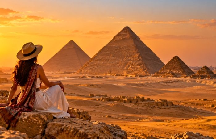
The Giza Plateau is particularly important for understanding the relationship between the river, ancient transportation, and monumental construction.
Although the pyramids stand away from the present riverbank, evidence of former waterways helps explain their original geographical context.
Visitors can combine Giza with Saqqara and other sites in the Memphite region.
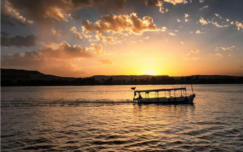
A Nile-side walk or short boat experience in Cairo can also provide a modern perspective on the river.
However, the river alone cannot reveal the ancient landscape exactly as it appeared during the Old Kingdom.
Luxor: The Nile and the religious capital of ancient Egypt
Recommended time: 2–3 days.
Luxor occupies the area of ancient Thebes, one of Egypt’s most important religious centers.
The Nile divides the modern city and helps organize the archaeological landscape.
On the east bank, visitors can explore major religious complexes.
On the west bank, royal tombs and funerary temples occupy the desert landscape.
This geographical relationship gives Luxor particular value for understanding ancient Egyptian beliefs about life, death, kingship, and religious journeys.
The Luxor Temple is especially useful for studying royal architecture and religious ceremonies.
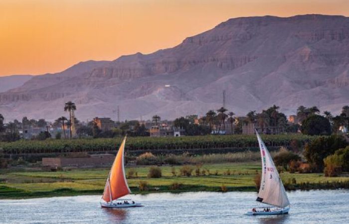
A traditional felucca ride can offer views of the river and surrounding landscape, although sailing conditions depend on the wind and the local operator.
Edfu: The Nile and the continuation of temple traditions
Recommended time: Approximately 1–2 hours at the temple, excluding transportation.
Edfu is located between Luxor and Aswan.
The Temple of Horus is one of Egypt’s best-preserved major ancient temple complexes.
Its surviving architecture is principally from the Ptolemaic period.
The temple demonstrates how Egyptian religious traditions continued long after the age of the pyramid builders.
Its location within the Nile Valley also reflects the continuing importance of river-connected settlements.
Edfu is commonly included in Nile cruise itineraries.
Kom Ombo: The Nile, crocodiles, and sacred geography
Recommended time: Approximately 1–1.5 hours.
Kom Ombo is located along the Nile between Edfu and Aswan.
Its unusual double temple arrangement is associated with Sobek and Haroeris.
The site’s setting near the river reinforces the importance of water and crocodile symbolism in Egyptian religious traditions.
Reliefs, architectural features, and nearby museum displays help visitors understand the local cult of Sobek.
Kom Ombo is a particularly useful stop for travelers interested in the connection between the natural environment and Egyptian religion.
Aswan: The Nile, Nubia, and Egypt’s southern frontier
Recommended time: 2 days, or longer if including Abu Simbel.
Aswan offers some of Egypt’s most distinctive Nile scenery.
The river passes around islands, granite formations, and areas of cultivated land.
Historically, the region formed an important connection between Egypt and Nubia.
The nearby First Cataract affected navigation and gave Aswan strategic importance.
Visitors can explore Elephantine Island, ancient quarries, Nubian heritage sites, and the modern dams.
One of the most significant attractions is the Philae temple complex, now located on Agilkia Island.
The temple’s relocation makes it especially relevant to the history of the Nile and modern heritage preservation.
Abu Simbel: Ancient monuments and the modern river
Recommended time: A long day excursion from Aswan, or an overnight visit.
Abu Simbel lies south of Aswan near Lake Nasser.
Its two temples were constructed during the reign of Ramesses II.
The site is significant both for ancient Egyptian royal history and for the international campaign that protected Nubian monuments during the construction of the Aswan High Dam.
The temples were moved to protect them from rising water.
Visiting Abu Simbel provides an unusual opportunity to understand two different periods of Egyptian engineering.
The original monuments demonstrate ancient construction capabilities, while their relocation reflects modern conservation technology.
Important planning distinction: Abu Simbel is not a standard stop on the typical Luxor–Aswan Nile cruise route. It generally requires a separate excursion from Aswan or a specialized Lake Nasser itinerary.
For additional locations along the river, explore the guide to Nile River tourist attractions.
How Can You Experience the Nile River in Egypt in 2027?
Travelers have several ways to experience the Nile.
The best choice depends on available time, budget, interest in archaeology, and whether the traveler prefers sailing or land-based sightseeing.
Nile cruise between Luxor and Aswan
A Nile cruise is one of the most convenient ways to explore several major archaeological sites along the river.
The traditional route connects Luxor and Aswan, with visits commonly including Edfu and Kom Ombo.
Typical itineraries may also include guided excursions in Luxor and Aswan.
Three-night Aswan-to-Luxor and four-night Luxor-to-Aswan programs are common, although operators may offer different schedules.
A cruise provides a useful perspective on the agricultural landscape.
Passengers can observe cultivated fields, villages, riverbanks, and the contrast between vegetation and desert.
For travelers studying the importance of the Nile, these views help connect the historical explanation with the modern geography.
Touring In Egypt offers information on Nile cruises from Luxor to Aswan for visitors comparing river-based travel options.
Felucca sailing in Aswan or Luxor
A felucca is a traditional sailing boat.
Short felucca trips offer a quieter, more direct connection with the river environment than larger cruise vessels.
Aswan is particularly well suited to this experience because of its islands, granite formations, and distinctive river scenery.
However, a felucca relies heavily on wind conditions, and travel times are less predictable.
A short trip may suit visitors who want a river experience without booking a multiday cruise.
Travelers should confirm the duration, route, return arrangements, safety equipment, and agreed price before departure.
Private land tours along the Nile Valley
A private land tour can connect major sites without requiring overnight accommodation on a cruise vessel.
This may be preferable for travelers who want more flexibility or longer visits at archaeological locations.
Road transportation can be particularly useful for visiting monuments that are not immediately beside the river.
However, it does not provide the continuous river views or onboard atmosphere associated with a cruise.
For travelers uncertain about the right approach, a comparison of a Nile cruise versus a land tour can help clarify the advantages and limitations.
Comparing ways to experience the Nile
| Experience | Typical duration | Best suited for | Main limitation |
| Cairo Nile boat ride | Around 1–2 hours | Visitors with limited time in Cairo | Primarily an urban river experience |
| Short felucca sailing | Around 1–2 hours | Travelers seeking traditional sailing and scenery | Wind conditions affect the route |
| Luxor or Aswan sightseeing | 1–3 days per city | Archaeology-focused visitors | Requires local transportation |
| Multiday Nile cruise | Commonly 3–4 nights or longer | Travelers seeking scenery and guided temple visits | Fixed schedules and docking arrangements |
| Private Nile Valley land tour | Flexible | Travelers who prefer independent timing and detailed site visits | Less time spent on the river |
| Lake Nasser excursion | Varies | Travelers interested in Nubian monuments and southern Egypt | Different route from a standard Nile cruise |
Durations are planning guidelines rather than confirmed 2027 schedules.
What Is the Best Time to Visit the Nile River in Egypt?
For many international travelers, October through April offers the most comfortable conditions for visiting archaeological sites along the Nile Valley.
During these months, daytime temperatures are generally more manageable than in the hottest parts of the year.
However, weather varies considerably between Cairo, Luxor, and Aswan.
October to November: Comfortable sightseeing conditions
Autumn is often a favorable period for visiting Egypt.
Temperatures generally begin to moderate after summer.
This can make walking through temples and archaeological sites more comfortable, although Upper Egypt may still experience hot afternoons.
These months can work well for Nile cruises, private tours, and outdoor sightseeing.
December to February: Cooler conditions
Winter is particularly popular with visitors interested in archaeology.
Luxor and Aswan usually experience mild daytime conditions compared with summer, although nights and early mornings can be cool.
Travelers should carry layers, especially for early departures and time spent on open boat decks.
December and the year-end holiday period can also be busy.
Cruise availability, hotel prices, and guide schedules may be affected by holiday demand.
March to April: Spring travel
Spring can offer favorable sightseeing conditions, but temperatures rise as summer approaches.
Egypt can also experience periods of dust and strong winds, including conditions associated with the khamsin.
Travelers should leave some flexibility in their schedules when outdoor activities are important.
May to September: Hot-weather travel
Summer temperatures in Upper Egypt can be very high.
Long walks around exposed archaeological sites may become uncomfortable, especially in the middle of the day.
Visitors traveling during this period should prioritize early sightseeing, shade, hydration, and suitable transportation.
Nile cruises may still operate, but outdoor excursions require careful planning.
For more detailed seasonal information, see the best time to visit Egypt guide.
What Should Travelers Know Before Visiting the Nile in 2027?
The Nile is a major part of an Egypt itinerary, but a few practical distinctions can prevent common planning mistakes.
A Nile cruise does not usually travel from Cairo to Aswan
Many first-time visitors imagine boarding a cruise in Cairo and sailing continuously through all of Egypt’s famous monuments.
Standard tourist Nile cruises are generally concentrated on the Luxor–Aswan route.
Other river experiences and specialized itineraries exist, but they are not interchangeable with standard cruises.
Travelers visiting Cairo, Giza, Luxor, and Aswan will usually combine different forms of transportation.
The river is not a substitute for visiting archaeological sites
A boat journey offers scenery and geographical context, but it does not replace the experience of visiting temples or tombs.
Important monuments can be situated away from the riverbank.
Excursions may require buses, private vehicles, or short transfers.
Visitors interested in history should select an itinerary with enough time at the archaeological sites themselves.
Do not assume all excursions are included
Cruise programs vary.
Some include guided sightseeing, entrance tickets, transportation, and meals.
Others may charge separately for some services.
Before booking, verify exactly which attractions are included and whether the itinerary requires optional excursions.
Accessibility varies significantly
Historic temples often have uneven stone surfaces, stairs, exposed areas, and limited accessible routes.
Cruise ships also differ in cabin access, lift availability, gangway arrangements, and mobility support.
Travelers with mobility requirements should confirm accessibility for the entire itinerary, including transfers and excursions.
Do not drink untreated Nile water
The Nile is an essential water resource, but untreated river water is not suitable for travelers to drink.
Use properly treated drinking water.
Swimming directly in the river is generally not recommended because of water quality, currents, boat traffic, and other local hazards.
Follow local regulations and professional safety guidance.
Confirm changing visitor details before travel
For 2027 travel, ticket prices, attraction access, restoration work, transportation arrangements, and cruise schedules may change.
Specific 2027 prices and operating conditions should not be assumed from earlier travel information.
Verify important details before booking, especially where a particular monument or cruise departure is central to the itinerary.
Suggested Nile River History Itinerary for First-Time Visitors
Travelers who want to understand why the Nile was important to ancient Egypt can organize their trip around the river’s historical roles.
A practical plan combines Cairo and Giza with Luxor and Aswan.
Day 1: Cairo and the Nile’s northern geography
Begin with a visit to an Egyptian museum to understand the development of ancient Egyptian civilization.
In the afternoon, explore the modern Nile waterfront.
Observe the river’s role in the city and consider how Cairo’s location near the Delta relates to earlier settlements.
A short boat ride can provide an introduction to the river.
Day 2: Giza and Saqqara
Visit the Giza Plateau to study pyramid construction, royal architecture, and the importance of transportation.
Continue to Saqqara if time allows.
Consider the relationship between the desert-edge monuments and the nearby agricultural floodplain.
The historical geography of these sites is an important part of understanding the Old Kingdom.
Day 3: Travel to Luxor
Travel to Luxor by a suitable domestic flight or other arranged transport.
Depending on arrival time, visit Luxor Temple or enjoy a short Nile-side walk.
Avoid planning a full day of sightseeing unless the arrival schedule genuinely allows it.
Day 4: Luxor’s east and west banks
Explore Karnak and the major east-bank monuments.
Then visit selected west-bank archaeological sites, including royal tombs and funerary temples.
The contrast between the east and west banks helps explain the symbolic importance of the Nile in ancient Egyptian religious geography.
Day 5: Travel through the Nile Valley
Continue toward Aswan, either by a scheduled Nile cruise or an arranged land transfer.
Where practical, include Edfu and Kom Ombo.
These sites demonstrate the continuation of Egyptian religious traditions during later historical periods.
Day 6: Aswan and Philae
Explore the river landscape around Aswan.
Visit the Philae temple complex and consider the relationship between ancient religious sites and modern water-management projects.
A felucca trip can offer a closer view of the islands and natural scenery.
Day 7: Aswan High Dam or Abu Simbel
Choose between a more relaxed Aswan day and an excursion to Abu Simbel.
The High Dam is particularly relevant for understanding how the modern river differs from the ancient Nile.
Abu Simbel demonstrates both royal monument construction and modern heritage preservation.
Travelers who prefer a slower pace may wish to add another day.
For a broader route covering these regions, review the Egypt itinerary planning guide.
Common Misconceptions About the Nile River in Ancient Egypt
Several widely repeated claims about the Nile require clarification.
Myth: The Nile was important only because it provided drinking water
Drinking water was essential, but the Nile also supported agriculture, transportation, trade, construction, religious traditions, and political administration.
Its importance came from the combination of these functions.
Myth: The Nile’s floods were always beneficial
A moderate, well-managed flood could support agriculture.
However, exceptionally low or high floods could create severe difficulties.
The agricultural system depended on the amount of available water and the ability to manage it.
Myth: Ancient Egyptians depended only on the Nile for every resource
Egypt also used resources from quarries, mines, deserts, oases, and foreign trading networks.
The Nile helped move materials but did not supply every resource directly.
Myth: All Egyptian monuments were built beside the modern river
Many ancient monuments are now located some distance from the present Nile.
River branches and floodplains changed over time.
Some monuments also occupied desert ground for religious, defensive, or practical reasons.
Myth: The pyramids were constructed using one simple method
Pyramid construction required multiple techniques, materials, and stages of organization.
River transportation was important, but it was only one component.
There is no single simple explanation that accounts for every element of pyramid construction.
Myth: Ancient Egypt and the Nile were isolated from the rest of Africa
Egypt had extensive connections with Nubia and other African regions.
The Nile system facilitated movement, trade, diplomacy, conflict, and cultural exchange.
Understanding ancient Egypt requires recognizing these wider African relationships.
Myth: The Nile River still floods Egyptian fields exactly as it did thousands of years ago
Modern dams regulate downstream river flow.
The annual inundation that structured ancient Egyptian agriculture no longer occurs in the same way across the modern Egyptian floodplain.
This is a fundamental distinction between ancient and modern Egypt.
Frequently Asked Questions About the Nile River and Ancient Egypt
Did all ancient Egyptians live near the Nile?
Most ancient Egyptians lived in settlements associated with the Nile Valley, Delta, or other places with access to dependable water. However, people also occupied oases, desert settlements, mining areas, and military outposts. The Nile supported the principal population centers because it provided fertile land and transportation, but ancient Egyptian activity extended well beyond its immediate banks.
Was the Nile River important to civilizations other than ancient Egypt?
Yes. The Nile supported communities and civilizations throughout northeastern Africa, including the kingdoms of Kush in Nubia. The river helped connect Egyptian and Nubian settlements through trade, political relationships, cultural exchange, and sometimes conflict. Its historical significance therefore extends beyond Egypt’s borders and includes the wider Nile Basin.
What are the Nile cataracts, and why were they important?
Nile cataracts are stretches of river characterized by rocky obstacles, rapids, or difficult navigation. The First Cataract near Aswan was especially important to ancient Egypt because it formed a significant geographical feature near the country’s traditional southern boundary. Cataracts affected river transport and helped shape settlement, trade, and military activity along the Nile.
Could ancient Egyptians farm without waiting for the annual flood?
Ancient Egyptians developed irrigation methods that allowed water to reach fields beyond the immediately flooded areas. However, much traditional agriculture depended strongly on the annual inundation. The ability to irrigate during drier periods improved over time as water-management techniques changed. Modern year-round irrigation should not be projected backward unchanged onto all periods of ancient Egyptian history.
Did ancient Egyptians use the Nile to transport gold?
The Nile was used to move valuable materials, including gold, along suitable transportation routes. Gold itself was obtained from mining regions, including parts of the Eastern Desert and Nubia. Riverboats could carry the material between settlements, administrative centers, and workshops, often as part of a larger transport system involving desert roads.
Did the ancient Egyptians build bridges across the Nile?
Boats and ferries were central to crossing the Nile in ancient Egypt. The river’s width, seasonal fluctuations, and changing channels made crossings a significant practical concern. Although small bridges and crossings could exist over canals or narrower waterways, there is no evidence of an extensive network of major bridges spanning the Nile comparable to modern Egyptian bridges.
Were crocodiles common in the ancient Nile?
Crocodiles were important animals in ancient Egyptian river environments and appear frequently in religious representations and ancient art. Their historical presence influenced beliefs associated with Sobek. Today, Nile crocodiles in Egypt are principally associated with Lake Nasser and areas upstream of the Aswan High Dam, rather than the usual Luxor–Aswan tourist cruise corridor.
Did women participate in the Nile-based economy?
Yes. Women participated in the economic and social life of ancient Egypt, although specific opportunities differed by status, household, and historical period. Their activities could include household production, textile work, food preparation, property management, and trade. Farming households depended on the contributions of multiple family members, but surviving sources do not describe every occupation equally well.
Why did the Egyptians bury boats near some royal tombs?
Boats could have practical, ceremonial, and religious significance. Some royal funerary complexes included boat pits or preserved vessels that may have been connected to royal burial rituals and beliefs about the afterlife. The solar journey of the sun god also gave boats symbolic importance. The exact interpretation of particular vessels depends on their archaeological context.
Is the Nile River still important to Egypt in 2027?
Yes. The Nile continues to play a fundamental role in Egypt’s water supply, agriculture, transportation, and economy. Modern dams and irrigation systems have changed how the river is managed, while tourism along the Nile supports travel-related businesses and communities. The river’s role has evolved, but its importance to Egyptian society remains substantial.
Conclusion: Why the Nile River Was the Foundation of Ancient Egypt
The Nile River was important to ancient Egypt because it made large-scale agriculture and permanent settlement possible in a predominantly dry landscape.
Its seasonal floods helped renew farmland, while its waters supported people, crops, and animals. The river also connected settlements, facilitated transportation and trade, and supplied the economic foundation for government, religion, specialized labor, and monumental construction.
The Nile influenced nearly every major aspect of ancient Egyptian civilization, from the organization of the agricultural calendar to the movement of limestone for the Great Pyramid.
Its historical importance becomes especially clear when visiting Giza, Luxor, Edfu, Kom Ombo, and Aswan. These places preserve evidence of how ancient communities worked with the river’s opportunities and challenges.
For travelers planning an Egypt journey, understanding the Nile adds meaning to the country’s archaeological sites and landscapes. It transforms the river from a scenic backdrop into a central part of Egypt’s historical story.
The Nile was not simply a river beside which ancient Egypt developed. It was the environmental foundation that helped make ancient Egyptian civilization possible.