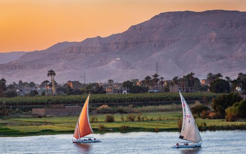
Quick Answer: Why is Egypt called the Gift of the Nile?
Egypt is called the Gift of the Nile because the Nile River provided the water, fertile soil, transportation, and agricultural resources that allowed ancient Egyptian civilization to develop in an otherwise largely desert environment. Its annual floods deposited nutrient-rich sediment along the valley, supporting farming, settlements, trade, and powerful kingdoms. The expression is traditionally associated with the Greek historian Herodotus, who recognized Egypt’s extraordinary dependence on the river.
Look at Egypt from above, and one geographical feature immediately stands out: a narrow green corridor running through enormous stretches of desert. That corridor follows the Nile River, the natural foundation of ancient Egyptian civilization.
For thousands of years, the Nile determined where people lived, what they grew, how they traveled, and where they built some of the world’s most recognizable monuments. The Great Pyramids of Giza, the temples of Luxor, and the ancient settlements around Aswan all belong to a history shaped by the river.
Understanding why Egypt is called the Gift of the Nile reveals something important about the country: its geography did not simply provide a setting for civilization. It influenced how Egyptian civilization worked.
The story also remains visible today. Modern travelers can follow the same geographical corridor through Cairo, Luxor, and Aswan, observing the relationship between fertile farmland, desert landscapes, ancient monuments, and the river that connects them.
Why Is Egypt Called the Gift of the Nile?
Egypt earned the description “Gift of the Nile” because the river transformed an arid landscape into a region capable of sustaining agriculture, permanent settlements, and a complex civilization.
Most of Egypt receives little rainfall, particularly away from the Mediterranean coast. Without a dependable source of freshwater, extensive farming in much of the Nile Valley would have been extremely difficult.
The Nile supplied that water.
Historically, its annual inundation also spread sediment across the floodplain. This material helped replenish agricultural soils and supported the cultivation of grain and other crops.
The importance of the river extended far beyond food production.
The Nile also connected different regions, supplied materials, supported trade, influenced religious beliefs, and helped rulers administer a kingdom stretching along its banks.
The five main reasons Egypt is called the Gift of the Nile
- Freshwater: The river supplied water for people, animals, irrigation, and everyday activities.
- Fertile agricultural land: Seasonal floods historically deposited rich sediment that helped farmers grow crops.
- Transportation: Boats carried people, agricultural products, stone, and other materials between settlements.
- Economic development: Agricultural production and trade supported cities, specialized occupations, and royal institutions.
- Civilization and culture: The Nile influenced Egyptian government, religion, festivals, art, architecture, and ideas about life and rebirth.
These benefits worked together.
Water made farming possible. Farming supported growing communities. Agricultural production helped sustain workers, administrators, craftspeople, and religious institutions.
Over many generations, these relationships contributed to the development of one of the ancient world’s most enduring civilizations.
The Nile did not build Egyptian civilization by itself. Ancient Egyptians developed the agricultural knowledge, political institutions, technologies, and cultural traditions that made effective use of the river.
The phrase therefore describes a relationship between geography and human achievement rather than suggesting that Egypt developed automatically because a river existed.
Who First Called Egypt the Gift of the Nile?
The description is traditionally associated with Herodotus, a Greek historian who lived during the fifth century BCE.
Herodotus visited Egypt and wrote about its geography, inhabitants, traditions, and the unusual behavior of the Nile River in his work The Histories.
In Book II, he described Egyptian land as a gift of the river.
His observation was particularly concerned with the way river-borne sediment had contributed to the formation of fertile land, especially in the Nile Delta.
The familiar English expression, “Egypt is the Gift of the Nile,” is a commonly used rendering of this idea.
What did Herodotus mean?
Herodotus recognized that Egypt’s natural environment differed significantly from many other Mediterranean regions.
Unlike places where agricultural production depended heavily on local seasonal rainfall, much of Egypt relied on water arriving through the Nile from regions farther south.
The river’s annual rise appeared especially remarkable because it occurred during the summer, when rain was scarce across much of Egypt.
The deposited sediment also provided evidence of the river’s ability to shape the landscape over long periods.
In other words, Herodotus was commenting on both the river’s practical importance and its role in the formation of Egyptian land.
His description was not simply poetic praise.
It reflected a geographical reality.
Did ancient Egyptians use the same expression?
The familiar English phrase is associated with Greek historical writing rather than being a direct translation of a universally used ancient Egyptian title.
However, ancient Egyptians clearly understood the river’s importance.
Their religious texts, agricultural practices, festivals, and representations of the inundation all demonstrate how closely they connected the Nile with fertility, prosperity, and survival.
They also used names for their country and landscape that reflected the distinction between cultivated land and surrounding desert.
These ideas existed independently of Herodotus’s later observations.
Why does the phrase remain famous?
The expression continues to be used because it summarizes a complicated historical relationship in a few words.
It connects the geography of Egypt with the emergence of Egyptian civilization.
More importantly, it remains understandable to modern visitors who can still see the strong contrast between green fields beside the Nile and the desert beyond them.
Where Is the Nile River, and How Did Geography Shape Ancient Egypt?
The Nile River runs through northeastern Africa and flows northward through Egypt before reaching the Mediterranean Sea.
Within Egypt, it passes through a long valley bordered by desert landscapes and eventually spreads into the Nile Delta in the north.
This arrangement created two important geographical regions: the Nile Valley and the Nile Delta.
Both were essential to ancient Egyptian civilization, but their landscapes and historical roles were different.
The Nile Valley: A narrow corridor through the desert
The Nile Valley is the long, cultivated corridor following the river through southern and central Egypt.
The valley varies in width, with fertile land extending outward from the river toward the surrounding desert.
Historically, settlements and agricultural communities concentrated on land that could be supplied with river water.
The adjacent deserts presented obstacles to extensive cultivation, although they also contained important resources, routes, and oases.
The resulting geography encouraged communities to develop along a shared river system.
It also made the Nile an especially important transportation route.
Instead of being spread evenly across a large territory, many Egyptian settlements followed a relatively narrow, connected corridor.
This arrangement had major consequences for communication, trade, government, and cultural exchange.
The Nile Delta: Where the river reaches the Mediterranean
The Nile Delta occupies northern Egypt, where the river system spreads across a broad, low-lying area before entering the Mediterranean Sea.
Its fertile soils and access to water made it an important agricultural region.
The Delta also provided connections between Egypt and the Mediterranean world.
Trade and communication between Egypt and surrounding regions were influenced by the Delta’s location.
Over thousands of years, the Delta’s channels, settlements, coastlines, and agricultural landscape changed.
The ancient river system was not identical to the present-day network of branches and canals.
Today, the main Nile branches reaching the Mediterranean are the Rosetta and Damietta branches.
Understanding this distinction matters because ancient Egyptian maps and modern maps do not always show the same waterways.
Upper Egypt and Lower Egypt: Why are the names reversed?
One of the most confusing aspects of ancient Egyptian geography is that Upper Egypt is in the south, while Lower Egypt is in the north.
The explanation is the direction of the Nile’s flow.
The river travels generally northward from higher elevations toward the Mediterranean Sea.
Therefore:
| Ancient geographical region | Location | Why it has that name | Important places |
| Upper Egypt | Southern Egypt | Upstream, toward the river’s higher course | Aswan, Luxor, Edfu |
| Lower Egypt | Northern Egypt | Downstream, toward the Delta and Mediterranean | Nile Delta, ancient Memphis region |
| Nile Valley | Long river corridor | Fertile land following the river | Luxor and numerous historical settlements |
| Nile Delta | Northern river plain | Area where the Nile spreads toward the sea | Rosetta, Damietta and wider Delta settlements |
The terms Upper and Lower are therefore geographical descriptions based on river elevation and direction, not on their positions on a north-oriented map.
This distinction was important throughout Egyptian history.
Why the location of Egyptian civilization mattered
Ancient Egypt developed in an unusual geographical environment.
The Nile connected the inhabited core of the country, while the surrounding deserts created considerable separation from many neighboring regions.
To the north lay the Mediterranean Sea.
To the east were the Eastern Desert, the Red Sea, and routes toward Sinai and western Asia.
To the west stretched the Western Desert, containing oases and routes across North Africa.
To the south were Nubia and the Nile’s cataract regions.
These natural features influenced Egypt’s relationships with neighboring peoples.
The deserts and cataracts could complicate movement, but they did not isolate Egypt completely.
Trade, migration, military activity, and cultural exchange continued across these landscapes throughout antiquity.
Ancient Egypt was both geographically distinctive and connected to the wider African and Mediterranean worlds.
Where Does the Nile’s Water Come From?
The water reaching Egypt through the Nile originates in a much larger drainage basin extending across northeastern and eastern Africa.
Two major river systems contribute to the Nile: the White Nile and the Blue Nile.
They meet at Khartoum in Sudan.
From there, the combined Nile continues northward toward Egypt.
The White Nile
The White Nile is associated with the Great Lakes region of equatorial Africa and the river systems that pass through South Sudan and Sudan.
Its waters help sustain the Nile’s flow during different parts of the year.
Wetlands, lakes, rainfall, and river channels across the wider basin influence how water moves downstream.
The White Nile is therefore an important part of the system supporting Egypt’s river.
The Blue Nile
The Blue Nile originates in Ethiopia, beginning at Lake Tana.
Seasonal rainfall across the Ethiopian Highlands historically played a particularly important role in Egypt’s annual summer inundation.
Heavy rains caused increased river flow and transported large quantities of sediment downstream.
Other tributaries, including the Atbara River, also contributed to the seasonal flood.
This explains an important historical puzzle.
Ancient Egyptians experienced rising river levels during the summer even though much of Egypt itself was extremely dry.
The water was arriving from wetter regions farther south.
Why this matters to the Gift of the Nile
Egypt’s agricultural prosperity was not created by local rainfall alone.
It depended on a river connecting different climates and regions across Africa.
Rainfall in the Ethiopian Highlands could influence the conditions of farmland hundreds of kilometers downstream in Egypt.
This geographical relationship made ancient Egypt part of a much larger natural system.
It also helps explain why changes in the Nile’s flow could have such serious consequences for Egyptian society.
How Did the Nile’s Annual Floods Make Egypt Fertile?
The ancient Nile’s annual inundation was one of the most important natural events in Egyptian history.
Before modern river regulation, water levels generally rose during the summer as seasonal rainfall increased the flow reaching Egypt from upstream.
The river could overflow its banks and spread across portions of the surrounding floodplain.
As the water slowed, some of the sediment it carried settled on the land.
When the floodwaters retreated, farmers could cultivate the moist, renewed soil.
This pattern helped make productive agriculture possible in a landscape where rainfall was often insufficient for extensive farming.
The natural process behind the Nile flood
The basic process followed several stages:
- Seasonal rains increased river flow in the Nile Basin, particularly in the Ethiopian Highlands.
- Rising water traveled north through Sudan and Egypt.
- Floodwater spread across parts of the Nile’s floodplain.
- Sediment settled as water movement slowed.
- Water levels gradually fell, leaving moist agricultural land.
- Farmers planted crops and managed irrigation according to local conditions.
The timing, height, and reach of the flood varied.
A flood was not equally beneficial every year.
Too little water could leave fields dry. Too much water could damage settlements and make agricultural work difficult.
The ideal inundation supplied sufficient water without causing destructive flooding.
Why was Nile silt important?
Silt is fine mineral material transported and deposited by moving water.
The Nile historically carried sediment that contributed to the fertility of Egypt’s floodplain.
This material helped maintain soils suitable for cultivation.
However, fertile land also depended on irrigation, soil management, labor, agricultural knowledge, and local environmental conditions.
It is therefore more accurate to say that sediment supported agricultural fertility than to suggest that every flood automatically produced a successful harvest.
The Nile’s agricultural importance came from the combination of water availability and productive land.
Did the Nile flood every year?
The historical Nile experienced a recurring annual flood cycle, but the strength of the inundation was not constant.
Some years brought relatively low water levels.
Others brought unusually high floods.
Ancient communities had to adapt to this variability.
Their survival depended partly on anticipating water conditions, managing agricultural land, storing food, and responding to difficult seasons.
The river was a source of life, but it was not completely predictable.
Why ancient floods should not be confused with modern conditions
Visitors to Egypt in 2027 should not expect to see the same broad annual inundation described in ancient history.
The construction of the Aswan High Dam transformed the way river water is stored and released.
Modern irrigation systems also differ significantly from the agricultural systems used in pharaonic times.
The green fields remain, but the process maintaining them has changed.
That distinction is essential to understanding both ancient Egypt and the present-day Nile.
How Did the Nile Shape the Ancient Egyptian Calendar?
The ancient Egyptian agricultural year was traditionally organized around three seasons associated with the river and farming.
These seasons were known as Akhet, Peret, and Shemu.
They reflected the relationship between water, cultivation, and harvest.
| Ancient season | General meaning | Agricultural significance |
| Akhet | Inundation | Period associated with rising and spreading floodwaters |
| Peret | Emergence or growing season | Land became available for cultivation and crops developed |
| Shemu | Harvest or dry season | Crops were gathered and agricultural work continued |
This three-season system illustrates how strongly environmental rhythms influenced Egyptian ideas about time.
The seasons were more than descriptions of weather.
They helped organize agricultural activities and were embedded in the wider calendar.
Akhet: The season of inundation
Akhet was traditionally associated with the annual rise of the Nile.
As water spread across agricultural land, some fields could not be cultivated in the usual way.
The inundation replenished moisture and contributed to the conditions needed for later agricultural production.
The flood also influenced the movement of people, agricultural work, and the organization of resources.
Peret: The season of emergence
Peret was associated with the period when floodwaters had receded and agricultural land became available for cultivation.
Farmers prepared fields and grew crops during the cooler part of the agricultural cycle.
The success of this work depended on the preceding water conditions as well as the availability of labor, seeds, and irrigation.
Shemu: The harvest season
Shemu was associated with harvesting and the drier part of the agricultural year.
Grain collected during successful harvests could be consumed, stored, exchanged, or collected through taxation and redistribution.
Food storage was especially important because agricultural communities needed supplies between harvests and during poor years.
Did these seasons follow exactly the same months every year?
The ancient Egyptian civil calendar and the natural flood cycle did not always remain perfectly aligned.
The 365-day civil calendar gradually shifted relative to the solar year because it did not originally include the same system of leap-year correction familiar today.
Consequently, the traditional names of the agricultural seasons should not be treated as permanent equivalents of fixed modern calendar months across all periods of Egyptian history.
For travelers, the important lesson is the relationship between the river, farming, and Egyptian timekeeping.
How Did the Nile River Support Ancient Egyptian Agriculture?
Agriculture was one of the most important foundations of ancient Egyptian society.
The Nile supplied water, supported fertile land, and helped create conditions in which farmers could produce food for large communities.
Ancient Egyptians cultivated several major crops, including emmer wheat, barley, flax, vegetables, and legumes.
They also grew fruit and maintained livestock.
The exact crops and farming methods varied according to location and historical period.
Grain production and food security
Emmer wheat and barley were especially important cereals.
Grain was used to produce staple foods, including bread and beer.
These products were central to the ancient Egyptian diet and economy.
Successful harvests supported households, while grain stores helped supply institutions and workers.
Agricultural production also contributed to the resources available to rulers, temples, and administrative organizations.
The availability of food did not eliminate hardship, inequality, or the risk of shortages.
Nevertheless, productive agriculture was essential to sustaining a complex civilization.
Flax and linen production
Flax was another significant agricultural resource.
The plant supplied fibers that could be processed into linen.
Linen was widely used for clothing and many other purposes in ancient Egyptian society.
It also played important roles in burial customs and religious practices.
The connection between agriculture and linen production demonstrates how the Nile supported activities beyond food cultivation.
A farming economy could supply materials for crafts, trade, and specialized production.
Vegetables, fruit, and household farming
Ancient Egyptian diets also included foods such as onions, garlic, lentils, dates, and figs, although availability differed across regions and periods.
Gardens and cultivated plots supplied additional food.
Farmers managed livestock and used agricultural by-products for practical purposes.
The Nile supported many interconnected activities, from cereal production to garden cultivation.
The resulting economy depended on the work of ordinary farmers as much as on the achievements of kings and priests.
How farmers managed water
Ancient Egyptian farmers did not simply wait for water to arrive and then leave their fields unattended.
They developed irrigation practices to capture, direct, and use river water.
One important system was basin irrigation.
Farmers used embankments and controlled areas of land to retain floodwater temporarily.
Water could then be managed and released according to agricultural needs.
Channels and other infrastructure helped distribute water.
These systems changed over time and were adapted to different locations.
The shaduf, a counterweighted water-lifting device known from later ancient Egyptian history, also helped raise water from lower levels to fields.
It became one of the recognizable technologies associated with Egyptian irrigation.
Why agricultural surplus mattered
A successful agricultural system could sometimes produce more food than farming households immediately consumed.
This surplus had important consequences.
It could support people working in occupations outside full-time farming.
These included administrators, craftspeople, priests, builders, and other specialists.
Agricultural resources also supported institutions that organized labor and large construction projects.
The relationship can be summarized as:
Nile water → productive agriculture → food resources → population and specialization → complex institutions and monumental projects.
This is one of the clearest ways to explain how the geography of the Nile helped shape ancient Egyptian civilization.
However, the process was neither automatic nor equally successful across every period.
Political organization, labor systems, technology, and decisions made by Egyptian communities were also essential.
How Did the Nile Influence the Development of Egyptian Civilization?
The Nile influenced where ancient Egyptians established settlements, how communities communicated, and how rulers organized the country.
The river supplied a common geographical route through which different regions could exchange people, goods, and ideas.
Over time, political organizations emerged and changed along this corridor.
Egypt eventually developed into a kingdom with powerful institutions, although its history included periods of unity, political division, foreign rule, and significant regional variation.
Why settlements developed beside the Nile
People needed access to water for drinking, farming, animals, and daily activities.
The Nile Valley offered opportunities for long-term settlement that were much more limited in the surrounding arid regions.
Communities established themselves in locations where they could use river resources while managing the risks associated with flooding.
Settlement patterns also reflected other considerations, including access to routes, agricultural land, building materials, and defensible positions.
Not every important settlement stood directly on the riverbank.
Some occupied nearby higher ground or locations offering practical advantages.
The wider Nile environment, rather than the water’s edge alone, shaped settlement decisions.
How the Nile helped connect Upper and Lower Egypt
The river provided a continuous corridor linking communities from the south toward the Delta.
Boats and river routes made communication possible over substantial distances.
This geographical connection was important to the development and administration of larger political territories.
Ancient Egyptian political unification is traditionally associated with the period around 3100 BCE and rulers connected with the early dynastic state.
The process of state formation was complex and developed over time.
It should not be reduced to a single event or the actions of one individual.
Readers interested in the beginnings of Egyptian kingship can explore the history of the first pharaoh of Egypt.
Memphis and the importance of location
Ancient Memphis developed near the transition between the Nile Valley and the Delta.
Its geographical position was significant because it connected important regions of the country.
Memphis became a major political and administrative center, particularly during the Old Kingdom.
Its surrounding necropolis includes some of Egypt’s most famous archaeological monuments.
This location demonstrates how river geography could influence political power.
A settlement close to routes connecting Upper and Lower Egypt held advantages for communication and administration.
The Nile and the growth of government
Managing a large agricultural territory required organization.
Ancient Egyptian institutions developed systems for collecting resources, recording information, organizing labor, and overseeing different regions.
Agricultural production was closely connected with these activities.
Officials could assess land, record goods, and help administer resources for royal and temple institutions.
The existence of a shared river corridor facilitated connections between regions.
However, successful government also depended on human institutions, political authority, and administrative practices.
Was the Nile the only reason Egypt became powerful?
No.
The Nile provided favorable environmental conditions, but it was not the only factor behind the development of Egyptian civilization.
Other important influences included:
- Agricultural technology and knowledge.
- Political organization and royal authority.
- Skilled labor and specialized crafts.
- Access to stone, minerals, and other resources.
- Regional trade and international connections.
- Religious and cultural institutions.
- Writing, recordkeeping, and administration.
The river was the foundation on which many of these systems developed.
The achievements themselves required generations of human effort.
Why Was the Nile Important for Transportation and Trade?
The Nile was ancient Egypt’s principal internal transportation route.
Moving heavy goods over long distances by land could be difficult, especially without modern roads or engines.
River transport offered significant advantages.
Boats could carry food, building materials, people, and commercial goods between settlements.
This helped connect agricultural regions with administrative centers, workshops, religious institutions, and ports.
How boats traveled in both directions
One unusual geographical advantage of the Nile was the relationship between its current and prevailing winds.
The river’s current flows generally northward.
Prevailing winds in Egypt often blow from the north.
Ancient sailors could use sails to help move southward, against the river’s current, when conditions were suitable.
Traveling northward could take advantage of the current.
This did not mean every journey was easy or that conditions were always favorable.
Boats, winds, currents, navigation obstacles, and seasonal water levels all influenced travel.
Nevertheless, the river provided an effective transportation corridor.
What did ancient Egyptians transport on the Nile?
River traffic included a wide range of goods and materials.
Agricultural products were especially important.
Grain, linen, food supplies, pottery, timber, stone, and manufactured goods could move between communities.
The Nile also supported the movement of people involved in trade, administration, construction, religious ceremonies, and military activity.
It connected different parts of the country and supported contact with neighboring regions.
Trade beyond Egypt
Ancient Egypt traded with neighboring territories and participated in wider exchange networks.
Contacts included Nubia to the south and regions connected through the Mediterranean and Near East.
Goods moved through combinations of river, desert, and maritime routes.
The Nile was an important component of these networks, but not the only route used.
Desert roads, Red Sea routes, and Mediterranean shipping were also significant.
How transportation influenced civilization
Reliable transport supported specialization.
Agricultural communities could supply food to larger centers.
Quarries could provide construction material for distant projects.
Workshops could produce goods intended for other regions.
Administrative institutions could move personnel and resources through the country.
The river therefore contributed to economic integration.
Its importance was not limited to the fields beside it.
How Did the Nile Help Ancient Egyptians Build the Pyramids and Temples?
The Nile played an important logistical role in the construction of major Egyptian monuments.
Ancient Egyptians used river transport to move materials and supplies between different locations.
This was particularly important for projects requiring large quantities of stone, food, tools, and organized labor.
However, the river should not be described as the sole explanation for Egyptian engineering achievements.
Construction depended on planning, skilled workers, quarrying, transport technologies, and extensive coordination.
The Pyramids of Giza
The Pyramids of Giza stand on a limestone plateau west of the modern Nile.
They were built during the Fourth Dynasty of the Old Kingdom.
Their construction required substantial resources and organized labor.
Much of the limestone used in the Great Pyramid came from local sources, while other stone was obtained from different locations.
River transport and associated waterways were important to moving certain materials toward the pyramid complex.
The precise reconstruction of ancient channels and harbor facilities remains an area of archaeological research.
Visitors should therefore avoid imagining that the modern Nile follows exactly the same route beside the pyramids as waterways did in antiquity.
The river landscape has changed considerably.
Saqqara and the development of pyramid architecture
The Saqqara Necropolis contains monuments that illustrate important stages in the development of Egyptian royal tomb architecture.
The Step Pyramid of Djoser, associated with the Third Dynasty, represents a major architectural development.
Saqqara’s position near ancient Memphis connected it with one of the country’s most important administrative regions.
The site also demonstrates the relationship between the fertile Nile environment and the desert plateau.
Cultivated land supported living communities, while adjacent desert areas offered locations for tombs and funerary complexes.
This geographical relationship shaped many ancient Egyptian burial landscapes.
Why desert plateaus were used for tombs
The agricultural floodplain was valuable for farming and settlement.
Desert plateaus offered different conditions.
They provided relatively dry terrain and access to stone.
Many royal and elite burial monuments were constructed in desert environments outside cultivated areas.
This separation was not absolute, and burial traditions varied across Egyptian history.
Still, the contrast between the living agricultural landscape and nearby funerary territory is visible at several major archaeological sites.
The importance of Aswan granite
Aswan was an important source of granite used in ancient Egyptian monuments.
Large stone blocks and unfinished monumental objects from the region illustrate the significance of its quarries.
Stone could be moved using a combination of land and river transportation.
Granite was particularly important for certain statues, obelisks, architectural elements, and other substantial objects.
This created another connection between the Nile and Egyptian monument construction.
The river helped link distant sources of raw material with major building centers.
Luxor’s monumental temples
Ancient Thebes, located around modern Luxor, became one of Egypt’s most important religious and political centers.
Its monumental architecture includes the Karnak Temple complex and Luxor Temple.
These structures demonstrate the resources and specialized labor that Egyptian royal and religious institutions could command.
The Nile supported the surrounding population, facilitated transportation, and connected the region to other parts of Egypt.
It was part of the economic and geographical framework within which these temples developed.
The relationship between water and monumental power
The Nile supported agriculture and trade.
Agricultural and economic resources helped sustain political and religious institutions.
Those institutions organized the construction and maintenance of monumental buildings.
The relationship was indirect but fundamental.
A river did not carve a statue or raise a temple column.
It helped sustain the society capable of organizing such achievements.
For visitors, this distinction makes the monuments more meaningful.
They represent human accomplishment made possible within a particular geographical environment.
Why Was the Nile River Important in Ancient Egyptian Religion?
The Nile was deeply connected with ancient Egyptian religious beliefs.
Its water supported life, while its seasonal rise and retreat were associated with fertility, renewal, and the continued functioning of the natural world.
Religious ideas surrounding the river developed over thousands of years.
Different gods, rituals, and regional traditions expressed particular aspects of its importance.
Hapy: The deity associated with the inundation
Hapy was an ancient Egyptian deity associated with the Nile’s annual inundation and the fertility it brought.
Hapy represented abundance and the life-supporting power of the flood.
Ancient Egyptian artistic representations often show Hapy with symbolic features associated with nourishment and prosperity.
The deity should not be confused with a simple personification of every aspect of the Nile.
Hapy was particularly connected with the inundation.
A successful flood supported crops and food supplies, making the deity’s association with abundance especially understandable.
Osiris and the idea of renewal
Osiris was closely associated with death, regeneration, kingship, and the afterlife.
The cyclical renewal of vegetation and agricultural life was connected with broader Egyptian ideas about regeneration.
The river’s seasonal rhythm helped provide a natural model for the concept of life returning after apparent disappearance.
These associations contributed to a religious worldview in which renewal was central.
However, Osiris was not simply another name for the Nile.
His religious significance extended far beyond the river.
Khnum and the southern Nile
Khnum, commonly represented with a ram’s head, held particular significance in the Aswan and Elephantine region.
Religious traditions associated Khnum with creation and the Nile’s waters.
Elephantine, near the First Cataract, was an important religious and strategic location.
Its position at the southern end of Egypt’s traditional river corridor contributed to local beliefs about the inundation and the river’s source.
Ancient Egyptian explanations of the Nile’s behavior combined observation with religious interpretation.
Modern hydrology explains the river’s flow through rainfall, geography, tributaries, and water movement across its basin.
Sobek and the crocodile
Sobek was a crocodile-associated deity worshipped in several parts of ancient Egypt.
Crocodiles were important animals in the Nile environment and could represent both danger and powerful divine qualities.
Sobek was associated with attributes including strength, protection, and aspects of fertility.
The Temple of Kom Ombo, located beside the Nile in Upper Egypt, is particularly relevant to this connection.
The temple complex honored Sobek and Horus the Elder.
Its location near the river makes it an especially useful site for understanding how the Nile environment influenced religious imagery.
Why temples stood close to the Nile
Many Egyptian temples were located within the Nile Valley because that was where important settlements and religious centers developed.
Water was also significant in purification rituals and sacred ideas about creation.
Some temple complexes included sacred lakes or other water-related features.
The river also supported the movement of ceremonial objects and processional boats.
Religious festivals could involve journeys between temples or the ceremonial transport of divine images.
These practices show how water, movement, and sacred geography were interconnected.
Not every temple was directly beside the river, and individual temple locations reflected many historical and practical considerations.
The Nile and ancient Egyptian ideas about life and death
Egyptian religious beliefs frequently connected natural cycles with broader ideas about existence.
The daily return of sunlight and the seasonal regeneration of cultivated land provided powerful images of renewal.
The Nile’s annual rise became part of this symbolic landscape.
Agricultural regeneration could suggest the continued possibility of life.
This relationship helps explain why the river appears in religious texts, temple decoration, funerary imagery, and artistic traditions.
The Nile was simultaneously a practical resource and a source of religious meaning.
What Is the Meaning of Kemet, the Black Land?
Ancient Egyptians used the name Kemet for their country.
The name is commonly understood as referring to the Black Land.
It is associated with the dark, fertile soil of the Nile Valley and Delta.
This land contrasted with the surrounding desert, commonly described through the concept of Deshret, the Red Land.
The two ideas help explain how Egyptians understood different parts of their landscape.
The Black Land
The Black Land referred to the fertile environment associated with the river.
Dark agricultural soils were important because they supported cultivation.
The Nile made this productive landscape possible through its water and the historical deposition of sediment.
The term therefore reflects the environmental importance of the river.
The Red Land
The Red Land was associated with desert territory outside the main cultivated zone.
These landscapes were generally less suitable for farming without access to water.
However, the deserts were not simply empty or useless.
They contained stone, minerals, travel routes, oases, settlements, and important religious and funerary sites.
Ancient Egyptian communities used desert resources and maintained connections across these regions.
The contrast between Black Land and Red Land should therefore be understood as a distinction between major landscape types rather than a complete division between inhabited and uninhabited territory.
Why these names matter
The terms Kemet and Deshret reveal how Egyptian ideas about geography were shaped by practical experience.
People recognized the difference between land that could support intensive agriculture and land where water was scarce.
This environmental contrast remained central to Egyptian civilization.
Visitors can still observe a similar geographical pattern today.
In many parts of the Nile Valley, cultivated fields end close to the desert.
The boundary can be surprisingly sharp.
This is one of the most effective ways to understand the phrase Gift of the Nile through the landscape itself.
What Other Resources Did the Nile Provide?
The Nile supplied more than water for irrigation.
Its wetlands, riverbanks, and surrounding agricultural environment supported a wide range of activities.
These resources influenced daily life, crafts, food production, transportation, and cultural expression.
Fish and food
Fish were an important resource in ancient Egypt.
The Nile and associated waterways contained species that could be caught and consumed.
Fishing appears in Egyptian art and archaeological evidence.
Fish could be eaten fresh or preserved.
River environments also supported other animals and contributed to the diversity of food sources available to communities.
However, the importance of fishing varied according to place, period, and social circumstances.
Papyrus
Papyrus grew in wetland environments associated with the Nile, particularly in the Delta.
Ancient Egyptians used the plant to manufacture writing material.
The stems were processed into sheets suitable for writing.
Papyrus also had other uses, including the production of lightweight objects and certain types of boats, baskets, and related items.
The availability of papyrus helped support Egyptian written communication.
However, Egyptian writing also appeared on stone, wood, pottery, and other materials.
The relationship between the Nile and writing was therefore significant but not exclusive.
Clay and mudbrick construction
River mud and other local materials were used in the production of mudbricks.
Mudbrick buildings were common in ancient Egyptian settlements.
The material was practical for constructing houses, walls, and many other structures.
Although stone monuments often receive the most attention today, much of everyday Egyptian life took place in buildings made from less durable materials.
The remains of these structures are important archaeological evidence.
They help researchers understand settlement organization, household activities, and ordinary life.
Plants, animals, and ecological resources
The Nile supported wetland vegetation and animal populations.
Birds, fish, crocodiles, and other species appeared in Egyptian art and religious imagery.
Plants provided food, fibers, and materials for practical objects.
The ecological richness of the river environment contributed to the cultural vocabulary of Egyptian civilization.
Animals and plants were not only resources.
They also became symbols through which Egyptians expressed ideas about gods, kingship, protection, and nature.
The river and Egyptian art
The Nile appears throughout ancient Egyptian visual culture.
Scenes of fishing, boating, hunting, farming, and marshland activities occur in tomb decoration and other artistic contexts.
These scenes reveal aspects of the relationship between Egyptians and their environment.
They may also contain religious or idealized elements.
A tomb painting should not always be interpreted as a literal photograph of everyday activities.
Nevertheless, Egyptian art preserves valuable evidence of the natural environment and the cultural significance assigned to it.
Travelers interested in these relationships can explore collections and exhibitions covered in the guide to Egyptian museums.
Was the Nile Always a Blessing for Ancient Egypt?
The Nile was essential to Egyptian civilization, but its annual flood was not always beneficial.
Agriculture depended on having sufficient water at the right time.
Both inadequate and excessive inundations could create serious difficulties.
This is an important qualification to the phrase Gift of the Nile.
The river made civilization possible, but dependence on it also created vulnerability.
What happened when the flood was too low?
A low inundation could leave agricultural land without sufficient water.
This might reduce the area available for cultivation or harm crops.
Poor harvests could contribute to food shortages and economic pressure.
The severity of such conditions depended on many factors, including stored food, irrigation infrastructure, political organization, and the duration of environmental difficulties.
It would be misleading to assume that every low flood automatically caused a famine.
However, prolonged or repeated agricultural failures could have serious consequences.
What happened when the flood was too high?
Excessive inundation could damage settlements, irrigation structures, agricultural land, and other infrastructure.
High water could also delay access to fields.
Agricultural work depended on the condition of the land after the floodwaters retreated.
The ideal flood was therefore not necessarily the largest possible flood.
It was one that provided enough water and sediment without causing extensive damage.
How did ancient Egyptians respond?
Ancient Egyptian communities developed methods to manage some of the uncertainty.
These included irrigation systems, agricultural planning, storage facilities, and administrative organization.
Food reserves could help during difficult periods.
Local knowledge also mattered.
Farmers needed to understand soils, water movement, and the timing of agricultural activities.
Religious responses were another part of Egyptian life.
Prayers, offerings, and rituals reflected the belief that divine powers influenced natural events.
Practical management and religious interpretation existed alongside one another.
What were nilometers?
Nilometers were structures or installations used to observe or measure the Nile’s water level.
They provided information about the river’s rise and changes in water height.
Some surviving examples are associated with later periods of Egyptian history.
Nilometers are important because they demonstrate how closely societies monitored the river.
They also illustrate the relationship between environmental observation and administrative concerns.
Water levels were relevant to expectations about agricultural conditions and, in some historical contexts, revenue and taxation.
A nilometer did not prevent floods.
Its value lay in providing information that could help people understand the river’s behavior.
How Did the Aswan High Dam Change the Gift of the Nile?
The Aswan High Dam fundamentally changed Egypt’s relationship with the Nile.
Built during the twentieth century, the dam created a major reservoir, Lake Nasser, and enabled much greater regulation of downstream river flow.
Its construction altered the historical pattern of annual inundation that had shaped Egyptian agriculture for thousands of years.
This is one of the most important differences between ancient Egypt and modern Egypt.
The Nile before the High Dam
Historically, Egypt experienced a seasonal river cycle.
Water levels rose during the annual inundation and declined afterward.
Floodwater spread across portions of the floodplain.
Farmers adapted their agricultural systems to changing water conditions.
Sediment transported by the river could settle across agricultural land during floods.
Communities also faced the risks associated with low and excessively high inundations.
The Nile after the High Dam
The Aswan High Dam made it possible to store large quantities of water and regulate releases downstream.
This supported expanded irrigation planning and hydroelectric power generation.
It also reduced the broad annual flooding that had traditionally affected Egyptian farmland.
However, dam regulation brought environmental and agricultural trade-offs.
Sediment that previously traveled farther downstream is now largely retained by the reservoir system.
Modern farming therefore depends on different combinations of irrigation, soil management, drainage, and fertilizers.
The dam also changed the river environment and affected communities and archaeological sites in Nubia.
The benefits and consequences of these changes are both important to understanding modern Egypt.
Why Lake Nasser matters
Lake Nasser is the large reservoir associated with the Aswan High Dam.
Its creation transformed the landscape of southern Egypt.
The rising waters threatened numerous archaeological sites in Egyptian and Sudanese Nubia.
An international campaign coordinated by UNESCO helped rescue and relocate important monuments.
Among the most famous were the temples of Abu Simbel and Philae.
The relocation efforts preserved major parts of the region’s cultural heritage, although the reservoir also permanently changed historical landscapes and communities.
The story connects modern engineering, water management, archaeology, and international heritage preservation.
Can visitors learn about these changes?
Yes.
Visitors to Aswan can explore several places associated with the river’s history.
The Aswan High Dam introduces the story of modern water management.
Elephantine Island is associated with ancient settlement, trade, and religious traditions.
Philae provides a remarkable example of archaeological conservation and relocation.
Together, these places demonstrate how Egypt’s relationship with the Nile has changed across different historical periods.
The river remains essential, but the technologies used to manage it are substantially different from those of ancient Egypt.
Is Egypt Still the Gift of the Nile Today?
Yes, the expression remains meaningful, although modern Egypt’s economy and infrastructure are much more diverse than those of ancient times.
The Nile continues to be a major freshwater resource for Egypt.
It supports agriculture, urban water needs, industry, and other activities.
The river corridor and Delta also remain important areas of settlement and economic activity.
However, contemporary water management involves challenges that differ from those of pharaonic agriculture.
Modern agriculture and irrigation
Modern Egyptian agriculture uses extensive networks of irrigation canals, drainage systems, pumps, and other infrastructure.
Agricultural practices are no longer organized around the same broad annual flood cycle that characterized ancient Egypt.
Farmers grow a wider range of crops, including many varieties introduced or developed long after the pharaonic period.
Irrigation enables production in areas that would otherwise receive insufficient rainfall.
Agricultural success depends on water availability, soil conditions, technology, markets, and environmental management.
Population and water demand
Egypt’s water needs are influenced by population growth, agriculture, industry, and urban development.
The Nile remains central to these discussions.
Efficient water management is therefore an important national concern.
Water conservation, agricultural practices, and environmental conditions all influence future sustainability.
The Nile Delta and environmental pressure
The Delta is a low-lying region facing challenges associated with coastal change, land use, salinity, and climate-related risks.
Some areas are vulnerable to rising sea levels and related environmental pressures.
Modern engineering and agricultural management can help communities adapt, but these issues remain significant.
The Nile is therefore not simply a historical subject.
Its condition and management continue to affect Egypt’s future.
Why the phrase still matters
The description Gift of the Nile captures a continuity between ancient and modern Egypt.
The same river system that supported early settlements continues to influence the geography of major cities and agricultural regions.
Yet the phrase should not hide the environmental and social challenges involved in depending on a major river.
The Nile is a source of opportunity, but also a resource that requires careful management.
What Can Travelers See Today That Explains the Gift of the Nile?
One of the most useful ways to understand the Gift of the Nile is to observe how historical sites relate to the surrounding geography.
Many of Egypt’s most important monuments stand near the river corridor.
Some occupy cultivated areas, while others are located on nearby desert plateaus.
Understanding these settings makes the archaeological sites easier to interpret.
The best places to explore this relationship include Cairo and Giza, Luxor, Edfu, Kom Ombo, and Aswan.
Cairo and Giza: Where the river helped support an ancient capital
Recommended time: 2–3 days for the wider Cairo and Giza area.
Cairo is one of the most important starting points for understanding the Nile’s role in Egyptian history.
The river runs through the modern metropolitan area, while major ancient sites lie farther to the west and south.
The Giza Plateau demonstrates the relationship between monumental construction and the historical landscape of the Nile.
The pyramids were built on desert terrain, but their construction was connected to the resources and transportation systems of the Nile Valley.
Nearby Saqqara and ancient Memphis provide additional historical context.
A visitor who explores both Giza and Saqqara can better understand why some major monuments were built outside the cultivated floodplain.
For a broader introduction to these historical relationships, the ancient archaeological sites of Egypt provide useful context.
What to notice: The transition between urban development, agricultural land, and the desert plateau.
Luxor: Where temples and tombs reflect the river’s geography
Recommended time: 2–3 days.
Modern Luxor occupies the site of ancient Thebes, one of Egyptian civilization’s most important religious centers.
The Nile separates the city’s east and west banks.
Major temples, settlements, and funerary sites developed across this landscape.
Karnak and Luxor Temple are on the east bank.
Many celebrated tombs and mortuary monuments lie on the west bank, including the Valley of the Kings.
This arrangement is often explained through Egyptian religious associations between the east, sunrise, life, and the west, sunset, and death.
That symbolism is important, although actual settlement and monument locations were influenced by numerous historical, practical, and religious factors.
The West Bank’s desert cliffs provide a dramatic backdrop to the green cultivated fields.
Travelers can see the contrast that helped shape ancient Egyptian life.
What to notice: How fertile fields occupy the valley floor while many tombs and funerary monuments stand in the desert hills beyond.
Edfu: A major temple within the Nile corridor
Recommended time: Approximately 1–2 hours at the temple, excluding transportation.
Edfu is located between Luxor and Aswan.
Its major archaeological attraction is the Temple of Horus.
The surviving temple largely belongs to the Ptolemaic period.
It is one of Egypt’s best-preserved ancient temple complexes.
The Temple of Edfu provides an excellent opportunity to study Egyptian religious architecture.
It also demonstrates the long continuation of Egyptian religious traditions in settlements along the river.
Edfu is a common stop on Nile cruise itineraries, although passengers generally transfer between the boat and temple rather than arriving directly inside the archaeological complex.
What to notice: The relationship between the temple, the modern settlement, and the agricultural surroundings.
Kom Ombo: A temple overlooking the Nile
Recommended time: Approximately 1 hour at the temple.
Kom Ombo is particularly valuable for understanding the religious significance of the river.
Its temple complex stands close to the Nile.
The site is associated with Sobek, the crocodile god, and Horus the Elder.
The location helps visitors connect ancient religious imagery with the natural environment of the river.
Kom Ombo is also a popular stop on Nile cruises between Luxor and Aswan.
From the river, visitors can appreciate the temple’s position above the water.
What to notice: The temple’s riverside setting and its religious association with crocodiles and the Nile environment.
Aswan: Where ancient and modern Nile history meet
Recommended time: 2 days, with additional time for Abu Simbel.
Aswan is one of the most revealing places to study the importance of the Nile.
The river passes through a landscape of islands, granite formations, and desert hills.
This region marked an important geographical and cultural frontier in ancient Egyptian history.
The First Cataract area influenced navigation and relationships with Nubia.
Aswan also supplied granite used in monumental construction.
Visitors can explore Elephantine Island, historic quarries, and the modern dam landscape.
A trip to Philae Island and its temple complex adds another dimension.
The monuments now stand on Agilkia Island following their relocation during the twentieth century.
What to notice: The rocky river channels, island landscapes, historical trade position, and visible evidence of modern water management.
The Nile Delta: Understanding the land created by sediment
The Nile Delta is less commonly included in short classical Egypt itineraries, but it is essential to understanding the original geographical meaning of the Gift of the Nile.
This broad agricultural region was formed through long-term river processes.
Its fertile landscape supported settlements, farming, and trade.
The Delta also connected Egypt with the Mediterranean world.
Travelers interested in geography rather than only monumental archaeology may find the region especially rewarding.
However, exploring the Delta requires a different approach from the familiar Cairo–Luxor–Aswan sightseeing route.
Attractions are more dispersed, and practical transportation should be planned according to specific locations.
Should You Take a Nile Cruise to Understand Ancient Egypt?
A Nile cruise can be an effective way to understand the geographical relationship between Egypt’s monuments and its river.
Most conventional sightseeing cruises operate between Luxor and Aswan.
These journeys combine travel on the Nile with visits to archaeological sites along or near the river corridor.
Passengers can observe agricultural land, river settlements, desert landscapes, and changing scenery between stops.
This experience helps explain why the Nile served as a transportation route for so much of Egyptian history.
However, a cruise is not necessary for every visitor.
A land-based itinerary can also provide excellent historical understanding.
Nile cruise versus land-based travel
| Factor | Nile cruise | Land-based tour |
| Main advantage | Experience the river while traveling between major sites | Greater flexibility over route and timing |
| Typical focus | Luxor, Edfu, Kom Ombo, Aswan | Any combination of cities and archaeological sites |
| Accommodation | Cruise vessel | Hotels |
| Transportation | Boat plus local road transfers | Private vehicle, train, flights or other transport |
| Historical experience | Strong emphasis on the river corridor | Can include both Nile sites and more distant attractions |
| Flexibility | Depends on vessel itinerary and navigation schedule | Often easier to customize |
| Best suited for | Travelers who want a river-centered experience | Travelers prioritizing independence or specific sites |
A cruise provides a distinctive perspective because the river becomes part of the journey rather than simply a feature seen between attractions.
Travelers considering this option can compare different Nile cruises from Luxor to Aswan.
Can you see the ancient Nile flood during a cruise?
No.
The historic annual inundation is no longer experienced in the same way along the regulated river.
Modern cruise passengers travel through a landscape shaped by contemporary water management.
The fields and settlements remain important, but their agricultural water supply now relies on managed irrigation.
A cruise is best understood as a way to observe the river’s continuing geographical importance, not as a recreation of its ancient flood cycle.
Does every Nile cruise visit Cairo?
No.
Many traditional Nile cruises focus on the route between Luxor and Aswan.
Cairo is usually visited separately, with transportation between Cairo and Upper Egypt arranged by air, train, or road.
Certain specialized and longer river journeys may operate on different routes, but travelers should not assume that a standard Luxor–Aswan cruise includes Cairo.
Checking the actual departure location, route, duration, and included excursions is essential.
Is a cruise better than a felucca?
A Nile cruise vessel and a felucca offer different experiences.
A conventional cruise provides accommodation and a scheduled sightseeing program.
A felucca is a traditional sailing boat commonly used for shorter river experiences.
A felucca ride is particularly suitable for visitors who want to experience the water without committing to a multi-day cruise.
Longer felucca journeys may also be available, but arrangements and comfort levels vary.
The right choice depends on the visitor’s schedule, expectations, and travel style.
How to Experience the Gift of the Nile in 2027
A traveler does not need to visit every ancient site to understand why Egypt is called the Gift of the Nile.
The most useful itinerary combines river scenery with places that explain agriculture, settlement, religion, and ancient engineering.
A well-planned route can show different dimensions of the river’s history without treating every monument as an unrelated attraction.
Option 1: One day in Cairo
Best for: Travelers with limited time.
A one-day introduction can include a major archaeological site and a view of the Nile.
A realistic approach is to begin with the Giza Plateau.
The pyramids provide a strong introduction to Egyptian royal power and the resources required for monumental construction.
Later, a visit to the Nile waterfront can help connect the modern city with the river’s historical importance.
For visitors who prefer museums, an appropriate Egyptian museum collection can provide additional insight into farming, boating, and everyday life.
Avoid trying to include Giza, Saqqara, multiple museums, and a long river excursion in one day.
Travel time and traffic make such schedules unnecessarily demanding.
Historical theme: How river-supported resources and transportation contributed to ancient royal civilization.
Option 2: Three days in Luxor
Best for: Travelers who want a deeper understanding of the Nile and ancient Egyptian beliefs.
A three-day Luxor visit provides enough time to connect major monuments with their landscape.
Day 1: East Bank
Explore Karnak Temple and Luxor Temple.
Pay attention to their locations within the ancient city and their relationship with the river.
Day 2: West Bank
Visit the Valley of the Kings and selected mortuary monuments.
Observe how the fertile plain transitions toward the desert cliffs.
Day 3: River and cultural context
Spend time experiencing the Nile, visiting suitable local museums, or exploring additional archaeological sites according to personal interests.
A river crossing or short boat experience can make the geographical relationship between both banks clearer.
Historical theme: How the Nile influenced religion, settlement geography, and royal burial traditions.
Option 3: Four days between Luxor and Aswan
Best for: Travelers interested in the river itself.
A typical four-day program can include major attractions in Luxor and Aswan, with stops at Edfu and Kom Ombo.
The actual itinerary depends on the cruise operator, sailing direction, and vessel schedule.
A Luxor-to-Aswan journey travels generally southward, upstream against the Nile’s natural current.
A journey from Aswan to Luxor travels generally northward, downstream.
For travelers interested in geography, this difference is worth understanding.
During the journey, observe the agricultural landscape and the proximity of villages to cultivated land.
Also notice how the river corridor changes in width and how desert hills appear beyond the fields.
Historical theme: The Nile as a transportation route connecting different religious and agricultural centers.
Option 4: Seven to ten days across Egypt
Best for: First-time international visitors who want a broader understanding.
A longer itinerary can combine Cairo, Giza, Luxor, and Aswan.
This route introduces several different historical relationships with the Nile.
Cairo and Giza explain the development of early royal power and monumental architecture.
Luxor illustrates major religious institutions, temples, and funerary landscapes.
Aswan demonstrates southern trade geography, granite resources, and modern river management.
Travelers with additional time can include a Nile cruise or more detailed visits to archaeological sites.
A longer trip also allows for a more comfortable pace.
For travelers organizing an extended route, an Egypt itinerary can help balance archaeological sightseeing with transport and rest days.
Which option is best for you?
| Traveler profile | Recommended experience | Main benefit |
| First-time visitor with limited time | Cairo and Giza | Introduces the relationship between ancient monuments and the Nile Valley |
| Ancient history enthusiast | Luxor | Strong combination of temples, tombs, and river geography |
| Traveler interested in nature and scenery | Nile cruise or Aswan | Opportunity to observe the river landscape |
| Family with children | Cairo museums and a short river experience | Combines visible geography with understandable historical examples |
| Photographer | Luxor and Aswan | Strong visual contrast between water, fields, and desert |
| Traveler with 7–10 days | Cairo, Luxor, and Aswan | Broader understanding of the river’s role across Egyptian civilization |
The best experience is not necessarily the one with the largest number of sites.
It is the route that allows sufficient time to understand what each location reveals.
What Is the Best Time to Explore the Nile in 2027?
For many international travelers, October through April offers more comfortable conditions for extensive sightseeing in Egypt.
This is particularly relevant for archaeological sites in Upper Egypt, where summer temperatures can be very high.
However, the best season depends on the activities planned.
A short boat ride, a multi-day Nile cruise, and long visits to exposed desert archaeological sites involve different levels of heat exposure.
October to April
These months are often preferred for sightseeing in Cairo, Luxor, and Aswan.
Conditions are generally milder than during peak summer, although temperatures vary considerably.
Winter mornings and evenings can be cooler, particularly during boat excursions.
Travelers should prepare for changing temperatures rather than assuming every day will be warm throughout.
Popular archaeological sites may also be busy during high-demand travel periods.
Advance planning can be useful for hotels, cruises, and guided experiences.
May to September
The warmer months can be challenging for visitors spending long periods outdoors.
This is especially important in Luxor and Aswan.
Early starts, suitable clothing, hydration, and realistic sightseeing schedules become more important.
Some travelers may prefer indoor museums or shorter outdoor visits during the hottest part of the day.
Cruise travel may still be possible depending on operator schedules, but river conditions should not be confused with guaranteed comfortable weather.
Seasonal comparison
| Period | General conditions | Planning recommendation |
| October–November | Often warm and suitable for outdoor sightseeing | Good period for combining temples and river activities |
| December–February | Generally milder days with cooler mornings and evenings | Useful for extensive archaeological sightseeing |
| March–April | Temperatures generally rise as spring progresses | Plan outdoor visits early and allow for possible wind or dust |
| May–September | Hot to very hot, especially in Upper Egypt | Prioritize hydration, shade, early starts, and shorter outdoor visits |
For detailed seasonal planning, consult the guide to the best time to visit Egypt.
What should travelers verify for 2027?
Before booking, check the published operating arrangements for the exact attractions and experiences you intend to visit.
Particular attention should be given to cruise departures, vessel schedules, site opening hours, admission arrangements, and any temporary access restrictions.
These details can change and should not be treated as fixed simply because an itinerary is labeled 2027.
Practical Tips for Understanding the Nile During Your Trip
A few simple planning decisions can make a Nile-focused journey considerably more rewarding.
1. Look beyond the monuments
The temples and pyramids are important, but the surrounding landscape explains why they exist where they do.
Pay attention to cultivated fields, irrigation channels, desert boundaries, and nearby settlements.
The relationship between water and land is central to the Gift of the Nile.
2. Understand the route before booking
A cruise advertised as a Nile experience may focus on a particular stretch of the river.
Check which cities are included.
Also confirm whether archaeological excursions, entrance tickets, local transfers, and guiding services are part of the arrangement.
3. Allow enough time at major sites
Understanding the geography of Luxor or Aswan requires more than quickly photographing the principal monument.
Allow time to observe the landscape.
A knowledgeable local guide can help connect historical structures with their original functions and surroundings.
4. Do not assume the Nile is suitable for swimming
River water quality, currents, navigation activity, and local conditions can create hazards.
Swimming in the Nile should not be treated as an ordinary sightseeing activity.
Choose established, appropriately operated boat experiences instead.
5. Carry water and protect yourself from the sun
Many archaeological sites offer limited shade.
In Upper Egypt, even a relatively short visit can involve significant heat exposure.
Carry drinking water, use sun protection, and plan rest periods.
6. Use river experiences selectively
A felucca ride, short river crossing, or cruise can add value when it helps explain the environment.
It is not necessary to book several similar boat experiences.
Choose one that fits your route and provides the perspective you want.
7. Separate ancient practices from modern ones
The fertile fields visible today are not maintained by exactly the same irrigation systems used in ancient Egypt.
Modern pumps, canals, and regulated water releases have changed agriculture.
Recognizing this difference improves historical understanding.
8. Respect working agricultural landscapes
Fields and villages beside the Nile are living communities and productive land.
They are not simply tourist attractions.
Ask permission before entering private property or photographing individuals at close range.
Responsible behavior supports more respectful cultural experiences.
Common Misconceptions About Egypt and the Gift of the Nile
Several popular explanations oversimplify the relationship between the Nile and Egyptian civilization.
Understanding these misconceptions makes the history clearer.
Misconception 1: The Nile created Egyptian civilization without human effort
The river provided essential resources, but people developed the farming methods, institutions, technologies, and cultural traditions that turned those resources into a complex civilization.
The Nile was a major environmental foundation, not a substitute for human achievement.
Misconception 2: Ancient Egyptians relied on rainfall within Egypt
Much of the water responsible for the historical annual inundation came from rainfall in upstream parts of the Nile Basin.
The Ethiopian Highlands were particularly important to the seasonal flood.
Local Egyptian rainfall was not the principal source of the ancient summer inundation.
Misconception 3: The Nile flows south
The Nile flows generally northward through Egypt toward the Mediterranean Sea.
This explains why Upper Egypt is in the south and Lower Egypt is in the north.
The terminology follows the river’s elevation and flow rather than the orientation of a modern map.
Misconception 4: Every Nile flood produced a good harvest
Floods varied in height and effect.
Insufficient water could damage agricultural production, while excessive flooding could create other problems.
Successful farming required suitable water levels, effective management, and favorable conditions.
Misconception 5: Egypt still floods as it did during pharaonic times
The Aswan High Dam fundamentally changed downstream flood regulation.
Modern agriculture depends on controlled water supply and irrigation infrastructure.
The historical annual inundation should not be presented as a normal experience for visitors today.
Misconception 6: Every ancient monument stood directly beside the Nile
Many monuments were connected to the Nile environment without standing immediately on the riverbank.
Some were built on desert plateaus or in nearby hills.
Transport routes, religious beliefs, geology, and practical considerations influenced their locations.
Misconception 7: All Egyptian history developed in the same way
Egyptian civilization changed over thousands of years.
Agriculture, settlement patterns, political institutions, religious practices, and transportation systems evolved.
An explanation that applies to the Old Kingdom may not describe every aspect of the New Kingdom or later periods.
Misconception 8: The Gift of the Nile refers only to farming
Agriculture was fundamental, but the river also influenced trade, political administration, communication, religion, construction, writing materials, and cultural traditions.
The expression describes an entire network of relationships.
Frequently Asked Questions About Egypt and the Gift of the Nile
Why is Egypt often called the Gift of the Nile?
Egypt is often called the Gift of the Nile because the Nile River supplied the water and fertile land needed to support ancient Egyptian agriculture and settlement. The river also provided transportation, encouraged trade, and contributed to the economic conditions that sustained cities, temples, and royal institutions. Without the Nile, the development of ancient Egyptian civilization in its familiar form would have been extremely difficult.
Why was the Nile River so important to ancient Egypt?
The Nile River was important to ancient Egypt because it provided freshwater, supported farming, connected settlements, and enabled the transportation of goods. Its seasonal floods historically helped replenish agricultural soils. The river also influenced religious beliefs, the agricultural calendar, political organization, and many aspects of daily life.
How did the Nile shape ancient Egypt’s geography?
The Nile created a long corridor of fertile land through otherwise largely arid territory. This encouraged settlements and farming communities to develop along the river and in the Delta. The surrounding deserts, cataracts, and nearby waterways influenced travel, trade, defense, and access to resources. Egyptian civilization therefore developed within a distinctive geographical environment.
Why did ancient Egyptians settle near the Nile?
Ancient Egyptians settled near the Nile because it offered access to water, agricultural land, fish, transportation, and other resources. Communities depended on reliable freshwater in a climate where rainfall was often limited. The river also connected settlements, making the exchange of goods and communication with other regions easier.
Why is the Nile called the gift of Egypt?
The expression “gift of Egypt” reverses the usual historical description. The familiar phrase is “Egypt is the Gift of the Nile.” It means that the Nile’s water, agricultural fertility, and transportation opportunities helped make Egyptian civilization possible. The phrase is traditionally associated with Herodotus, a Greek historian who wrote about Egypt during the fifth century BCE.
What would ancient Egypt have been like without the Nile?
Without the Nile, the region would have lacked the same extensive freshwater corridor and fertile floodplain that supported ancient Egyptian settlements and agriculture. Different communities might still have occupied areas with other water sources, but the civilization known from the Nile Valley, with its major cities, agricultural economy, and monumental architecture, would have developed very differently, if at all.
Why was the Nile Delta important to ancient Egypt?
The Nile Delta was important because it provided fertile agricultural land and access to routes connecting Egypt with the Mediterranean region. Its geography supported farming, settlement, and trade. The Delta also formed the core of Lower Egypt, one of the two principal geographical regions of the ancient Egyptian kingdom.
How did the Nile affect ancient Egyptian religion?
The Nile influenced ancient Egyptian religion because its waters supported life and agricultural renewal. Hapy was associated with the inundation, while other deities, including Khnum and Sobek, had important connections with river-related traditions. The seasonal return of fertility also contributed to Egyptian ideas about regeneration and the natural order.
How did the Nile River help the pharaohs?
The Nile helped support the agricultural production, transportation, and communication systems on which royal institutions depended. It facilitated the movement of food, materials, and people between different parts of Egypt. These resources supported administration, temple institutions, and large construction projects, although the organization of such activities also depended on human labor and political authority.
Does the Nile River still flood Egypt every year?
The Nile no longer causes the same widespread annual agricultural inundation that characterized ancient Egypt. The Aswan High Dam and modern water-management infrastructure regulate much of the river’s downstream flow. Localized changes in water levels and flooding risks can still occur, but the historical flood cycle no longer determines Egyptian agriculture in the same way.
Can tourists visit the Nile River in Egypt?
Yes. Travelers can experience the Nile in Cairo, Luxor, Aswan, and other Egyptian cities. Common activities include short boat rides, felucca experiences, river crossings, and multi-day Nile cruises. Visitors can also explore archaeological sites along the river corridor to understand its historical importance. Specific boat schedules and attraction access should be checked before traveling.
Is the Nile River still important to Egypt today?
Yes. The Nile remains one of Egypt’s most important freshwater resources and continues to support agriculture, urban water needs, and economic activity. Modern infrastructure has changed how its water is managed, but the river remains central to Egypt’s geography and long-term environmental challenges.
Conclusion: Why Egypt Truly Is the Gift of the Nile
Egypt is called the Gift of the Nile because the river created the environmental conditions that made ancient Egyptian civilization possible.
Its water supported agriculture, its floods historically renewed fertile soils, and its transportation routes connected communities across the country.
These advantages helped sustain settlements, trade, political institutions, religious traditions, and the resources required for Egypt’s monumental architecture.
Yet the story is larger than the river alone.
Ancient Egyptians transformed these natural opportunities through farming, engineering, administration, craftsmanship, and cultural innovation.
The Nile supplied the foundation. Egyptian civilization was built through human effort.
For travelers visiting Egypt in 2027, the meaning remains visible in the landscape. The green fields near Luxor, the temples overlooking the river, the islands of Aswan, and the fertile Delta all reveal different parts of this relationship.
To understand the country more deeply, look not only at its pyramids and temples, but also at the river system that helped sustain the people who created them.
Travelers who would prefer a historically focused itinerary connecting Cairo, Luxor, and Aswan can explore customized Egypt private tours with Touring in Egypt.
The most meaningful Egypt journey connects the monuments with the geography that made them possible.